
Cloud facts for kids

A cloud is water vapour in the atmosphere (sky) that has condensed into very small water droplets or ice crystals that appear in visible shapes or formations above the ground.
Water on the Earth evaporates (turns into an invisible gas) and rises up into the sky. Higher up where the air is colder, the water condenses: it changes from a gas to drops of water or crystals of ice. We see these drops of water as clouds. The drops fall back down to earth as rain, and then the water evaporates again. This is called the "water cycle".
The atmosphere always has some water vapour. Clouds form when the atmosphere can no longer hold all the invisible air vapor. Any more water vapor condenses into very small water drops.
Warm air holds more water vapor than cool air. So if warm air with lots of water inside cools, it can form a cloud. These are ways air can cool enough to form clouds:
- when air close to the ground is heated by the sun and rises to where the air is colder.
- along weather fronts warmer air is cooled as it runs into colder air;
- when air goes up the side of a mountain it cools as it goes higher;
- when warm air goes over something colder such as cool water in a lake) or ground that is cooled at night it cools.
Clouds are heavy. The water in a cloud can have a mass of several million tons. Every cubic metre (m3) of the cloud has only about 5 grams of water in it. Cloud droplets are also about 1000 times heavier than evaporated water, so they are much heavier than air. They do not fall, but stay in the air, because there is warm air all round the heavier water droplets. When water changes from gas to droplets, this makes heat. Because the droplets are very small, they "stick" to the warm air.
Sometimes, clouds appear to be brilliant colors at sunrise or sunset. This is due to dust particles in the air.
Contents
Cloud classification
Clouds are classified according to how they look and how high the base of the cloud is in the sky. This system was suggested in 1803. There are different sorts of clouds because the air where they form can be still or moving forward or up and down at different speeds. Very thick clouds with large enough water droplets can make rain or snow, and the biggest clouds can make thunder and lightning.
There are five basic families of clouds based on how they look:
- Cirrus clouds are high and thin. The air is very cold at high levels, so these clouds are made of ice crystals instead of water droplets. Cirrus clouds are sometimes called mares' tails because they look like the tails of a horse.
- Stratus clouds are like flat sheets. They may be low-level clouds (stratus), medium-level (altostratus), high-level (cirrostratus), or thick multi-level clouds that make rain or snow (nimbostratus).
- Stratocumulus clouds are in the form of rolls or ripples. They may be low-level clouds (stratocumulus), medium-level (altocumulus), or high-level (cirrocumulus).
- Cumulus clouds are puffly and small when they first form. They may grow into heap clouds that have moderate vertical extent (nothing added to the name), or become towering vertical clouds (towering cumulus).
- Cumulonimbus clouds are very large cumulus-type clouds that usually develop cirrus tops and sometimes other features that give them their own unique look.
The following is a summary of the main cloud types arranged by how high they form:
High-Level clouds

High clouds form from 10,000 to 25,000 ft (3,000 to 8,000 m) in cold places, 16,500 to 40,000 ft (5,000 to 12,000 m) in mild regions and 20,000 to 60,000 ft (6,000 to 18,000 m) in the very hot tropics. They are too high and thin to produce rain or snow.
High-level clouds include:
- Cirrus (Ci)
- Cirrocumulus (Cc)
- Cirrostratus (Cs)
Medium-level clouds
Middle clouds usually form at 6,500 ft (2,000 m) in colder areas. However, they may form as high as 25,000 ft (8,000 m) in the tropics where it's very warm all year. Middle clouds are usually made of water droplets but may also have some ice crystals. They occasionally produce rain or snow that usually evaporates before reaching the ground.
Medium-level clouds include:
- Altocumulus (Ac)
- Altostratus (As)
Low-level clouds
Low-level clouds are usually seen from near ground level to as high as 6,500 ft (2,000 m). Low clouds are usually made of water droplets and may occasionally produce very light rain, drizzle, or snow.
Low-level clouds include:
- Stratocumulus (Sc)
- Stratus (St)
When very low stratus cloud touches the ground, it is called fog.
Moderate-vertical clouds

These are clouds of medium thickness that can form anywhere from near ground level to as high as 10,000 ft (3,000 m). Medium-level cumulus does not have alto added to its name. The tops of these clouds are usually not much higher than 20,000 ft (6,000 m). Vertical clouds often create rain and snow. They are made mostly of water droplets, but when they push up through cold higher levels they may also have ice crystals.
Moderate-vertical clouds include:
- Cumulus (Cu)
- Nimbostratus (Ns)
Towering-vertical clouds
These clouds are very tall with tops usually higher than 20,000 ft (6,000 m). They can create heavy rain and snow showers. Cumulonimbus, the biggest clouds of all, can also produce thunderstorms. These clouds are mostly made of water droplets, but the tops of very large cumulonimbus clouds are often made mostly of ice crystals.
Towering-vertical clouds include:
- Towering cumulus (Tcu)
- Cumulonimbus (Cb)
Images for kids
-
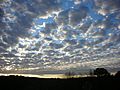
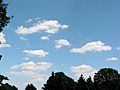
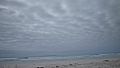
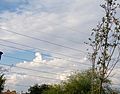
Stratocumuliform cloudscape
-
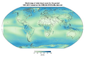
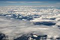
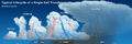
Total cloud cover fraction averaged over the years 1981-2010 from the CHELSA-BIOCLIM+ data set
-
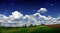
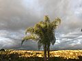
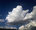
Cumulus humilis clouds in May
-
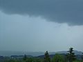
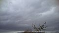
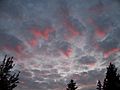
Nimbostratus cloud producing precipitation
-
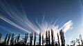
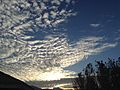
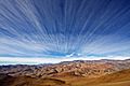
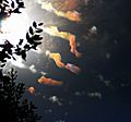
Cirrus fibratus clouds in March
-
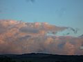
Stratocumulus over Orange County.
-
Stratocumulus cloud
-
Cumulus humilis clouds
-
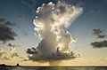
Cumulonimbus cloud over the Gulf of Mexico in Galveston, Texas
-
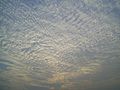
A large field of cirrocumulus
-
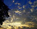
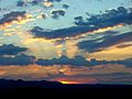
Sunrise scene giving a shine to an altocumulus stratiformis perlucidus cloud (see also 'species and varieties')
-
Altostratus translucidus near top of photo merging into altostratus opacus near bottom
-
Stratocumulus stratiformis perlucidus over Galapagos, Tortuga Bay (see also 'species and varieties')
-
Stratus nebulosus translucidus
-
Deep multi-level nimbostratus cloud covering the sky with a scattered layer of low stratus fractus pannus (see also 'species' and 'supplementary features' sections)
-
Cumulus humilis and cumulus mediocris with stratocumulus stratiformis perlucidus in the foreground (see also 'species and varieties')
-
Towering vertical cumulus congestus embedded within a layer of cumulus mediocris: Higher layer of stratocumulus stratiformis perlucidus.
-
Progressive evolution of a single cell thunderstorm
-
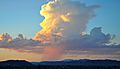
Isolated cumulonimbus cloud over the Mojave Desert, releasing a heavy shower
-
Altocumulus lenticularis forming over mountains in Wyoming with lower layer of cumulus mediocris and higher layer of cirrus spissatus
-
Example of a castellanus cloud formation
-
Cumulus mediocris cloud, about to turn into a cumulus congestus
-
A layer of stratocumulus stratiformis perlucidus hiding the setting sun with a background layer of stratocumulus cumulogenitus resembling distant mountains.
-
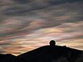
Cirrus fibratus radiatus over ESO's La Silla Observatory
-
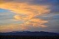
Altocumulus stratiformis duplicatus at sunrise in the California Mojave Desert, USA (higher layer orange to white; lower layer grey)
-
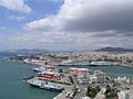
Cumulus partly spreading into stratocumulus cumulogenitus over the port of Piraeus in Greece
-
Cumulonimbus mother cloud dissipating into stratocumulus cumulonimbogenitus at dusk
-
Cirrus fibratus intortus formed into a Kármán vortex street at evening twilight
-
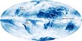
Global cloud cover, averaged over the month of October 2009. NASA composite satellite image.
-
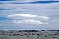
Lenticular nacreous clouds over Antarctica
-
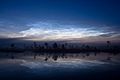
Noctilucent cloud over Estonia
-
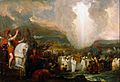
Joshua Passing the River Jordan with the Ark of the Covenant (1800) by Benjamin West, showing Yahweh leading the Israelites through the desert in the form of a pillar of cloud, as described in Exodus 13:21–22
-
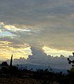
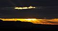
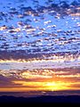
Stratocumulus stratiformis and small castellanus made orange by the sun rising
-
An occurrence of cloud iridescence with altocumulus volutus and cirrocumulus stratiformis
-
Sunset reflecting shades of pink onto grey stratocumulus stratiformis translucidus (becoming perlucidus in the background)
-
Stratocumulus stratiformis perlucidus before sunset. Bangalore, India.
-
Particles in the atmosphere and the sun's angle enhance colors of stratocumulus cumulogenitus at evening twilight
.jpg)


.jpg)


See also
 In Spanish: Nube para niños
