
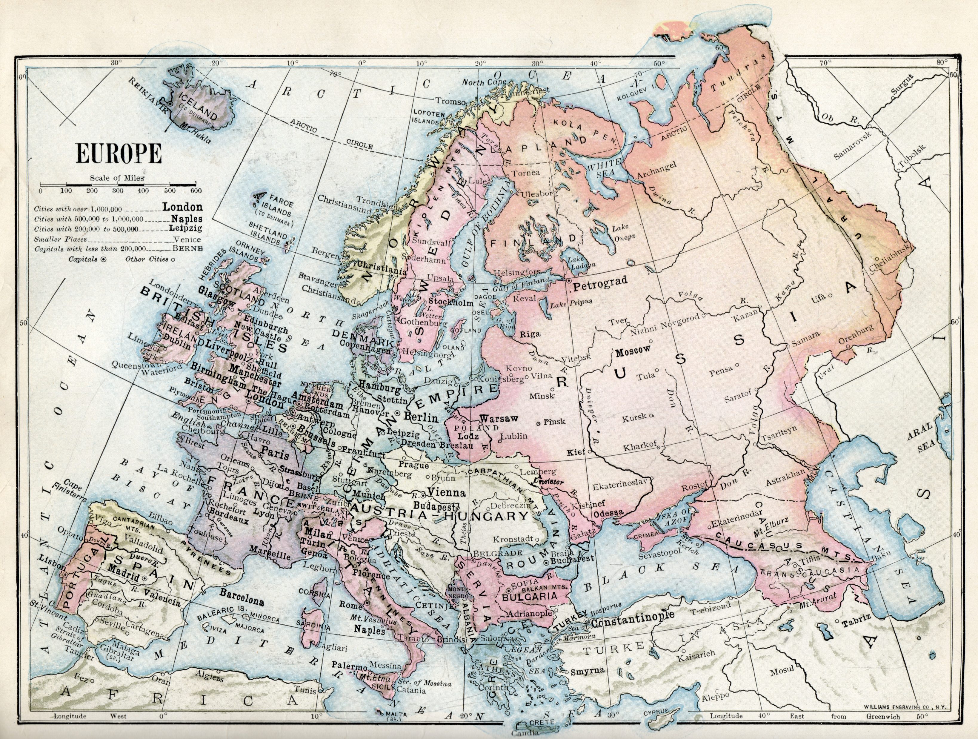
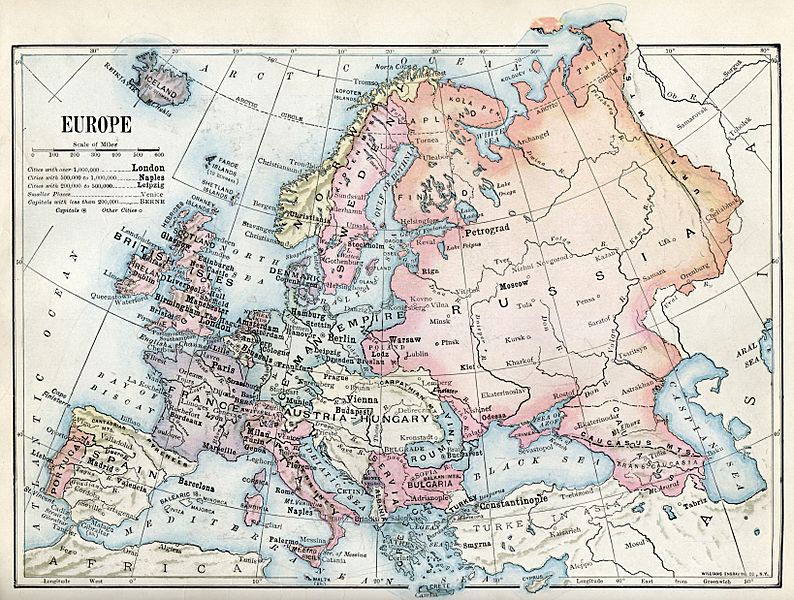
Image: 1916 political map of Europe
Size of this preview: 794 × 600 pixels. Other resolutions: 318 × 240 pixels | 3,276 × 2,475 pixels.
Original image (3,276 × 2,475 pixels, file size: 9.61 MB, MIME type: image/jpeg)
Description: 1916 political map of Europe from a geography textbook
Title: 1916 political map of Europe
Credit: Tarr and McMurry, "New Introductory Geography", MacMillan Co., 1916, p. 152. I scanned it from a hardcopy of the book, which I purchased at an antique shop.
Author: Ralph Stockman Tarr
Usage Terms: Public domain
License: Public domain
Attribution Required?: No
Image usage
The following 2 pages link to this image:

All content from Kiddle encyclopedia articles (including the article images and facts) can be freely used under Attribution-ShareAlike license, unless stated otherwise.