
Image: 2000census- Black Residential Segregation
No higher resolution available.
2000census-_Black_Residential_Segregation.JPG (700 × 558 pixels, file size: 233 KB, MIME type: image/jpeg)
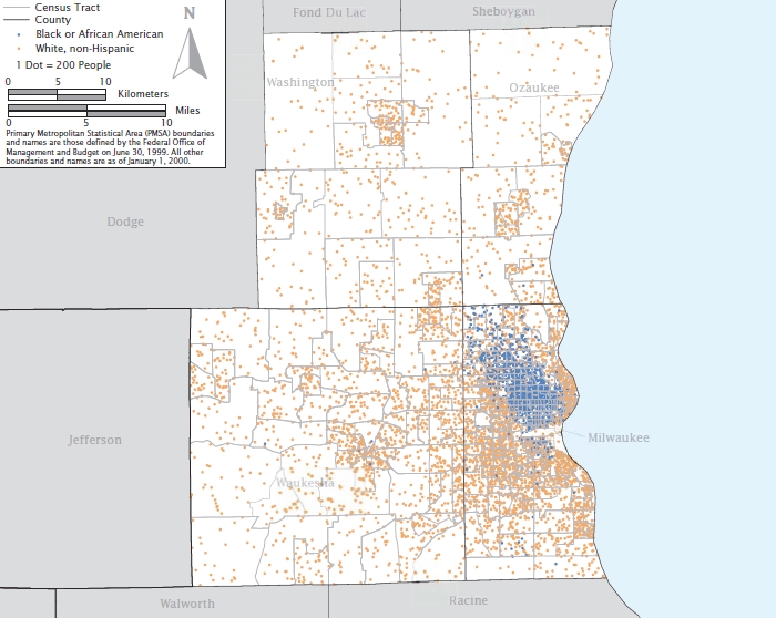
Description: A map showing residential black segregation in the 2000 Census' most segregated American city, Milwaukee, Wisconsin.
Title: 2000census- Black Residential Segregation
Credit: US Census Bureau (https://www.census.gov/hhes/www/housing/housing_patterns/pdf/Fig5-3.pdf)
Author: US Census Bureau, 2000 Census
Usage Terms: Public domain
License: Public domain
Attribution Required?: No
Image usage
The following page links to this image:

All content from Kiddle encyclopedia articles (including the article images and facts) can be freely used under Attribution-ShareAlike license, unless stated otherwise.