
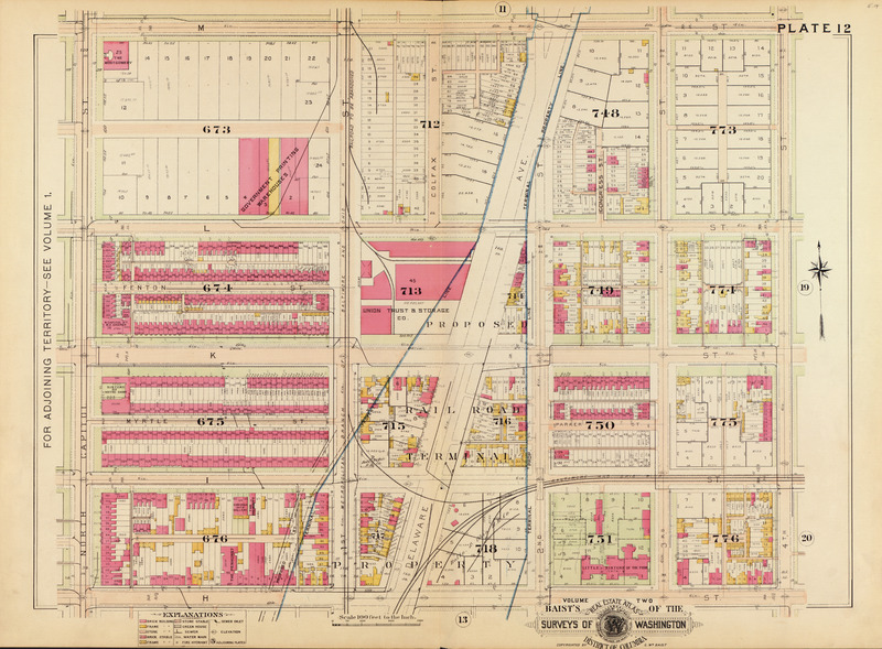
Image: Baist's real estate atlas of surveys of Washington, District of Columbia - Plate 12
Size of this JPG preview of this TIF file: 800 × 589 pixels. Other resolution: 320 × 236 pixels.
Original image (9,216 × 6,790 pixels, file size: 179.06 MB, MIME type: image/tiff)
Description: Baist's real estate atlas of surveys of Washington, District of Columbia - Plate 12
Title: Baist's real estate atlas of surveys of Washington, District of Columbia - Plate 12
Credit: Baist's real estate atlas of surveys of Washington, District of Columbia : complete in three volumes
Author: Philadelphia : George William Baist, 1903.
Usage Terms: Public domain
License: Public domain
Attribution Required?: No
Image usage
The following page links to this image:

All content from Kiddle encyclopedia articles (including the article images and facts) can be freely used under Attribution-ShareAlike license, unless stated otherwise.