
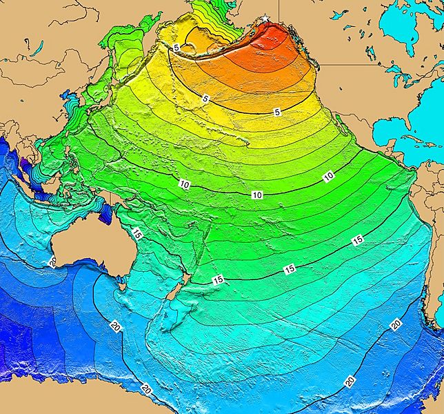
Image: Calculated Travel Time Map for 1964 Alaska Tsunami

Size of this preview: 644 × 600 pixels. Other resolutions: 258 × 240 pixels | 859 × 800 pixels.
Original image (859 × 800 pixels, file size: 326 KB, MIME type: image/jpeg)
Description: Calculated travel time map for the tectonic tsunami produced by the 1964 Prince William Sound earthquake in Alaska. Tsunami Travel Times computed using TTT v3.1 (P. Wessel). Red: 1-4 hour arrival times; yellow: 5-6 hour arrival times; gre7-14 hour arrival times; blue: 15-21 hour arrival times.
Author: NGDC
Usage Terms: Creative Commons Attribution-Share Alike 3.0
License: CC-BY-SA-3.0
License Link: http://creativecommons.org/licenses/by-sa/3.0/
Attribution Required?: Yes
Image usage
The following page links to this image:

All content from Kiddle encyclopedia articles (including the article images and facts) can be freely used under Attribution-ShareAlike license, unless stated otherwise.