
Image: Conquista Hispania

Size of this PNG preview of this SVG file: 800 × 547 pixels. Other resolution: 320 × 219 pixels.
Original image (SVG file, nominally 950 × 650 pixels, file size: 1.07 MB)
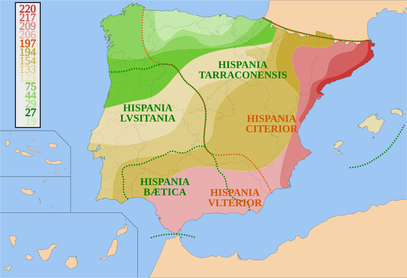
Description: Map of Spain and Portugal showing the conquest of Hispania from 220 B.C. to 19 B.C. and provincial borders. It is based on other maps; the territorial advances and provincial borders are illustrative.
Title: Conquista Hispania
Credit: Own work
Author: HansenBCN
Usage Terms: Creative Commons Attribution-Share Alike 3.0
License: CC BY-SA 3.0
License Link: http://creativecommons.org/licenses/by-sa/3.0/
Attribution Required?: Yes
Image usage
The following 3 pages link to this image:

All content from Kiddle encyclopedia articles (including the article images and facts) can be freely used under Attribution-ShareAlike license, unless stated otherwise.