
Image: HRR 1789 EN

Size of this preview: 736 × 600 pixels. Other resolutions: 295 × 240 pixels | 2,650 × 2,160 pixels.
Original image (2,650 × 2,160 pixels, file size: 2.69 MB, MIME type: image/png)
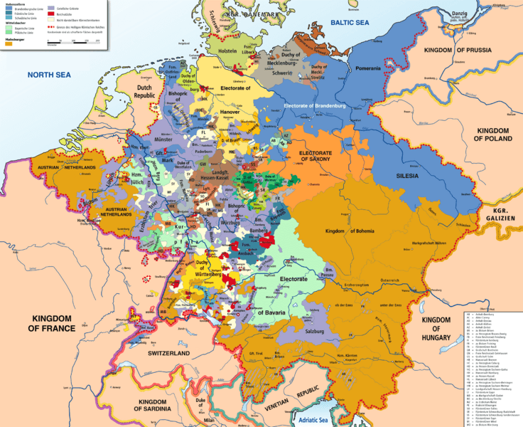
Description: Map of the Holy Roman Empire, 1789, translated (somewhat) from original German version on Wikipedia Commons
Title: Map of the Holy Roman Empire, 1789 en
Credit: Own source, translated map from Image:HRR 1789.png, also on WC
Author: Robert Alfers, kgberger
Usage Terms: Public domain
License: Public domain
Attribution Required?: No
Image usage

All content from Kiddle encyclopedia articles (including the article images and facts) can be freely used under Attribution-ShareAlike license, unless stated otherwise.