
Image: Hong Kong 18-25 December 1941
Size of this preview: 800 × 558 pixels. Other resolutions: 320 × 223 pixels | 1,855 × 1,293 pixels.
Original image (1,855 × 1,293 pixels, file size: 823 KB, MIME type: image/png)
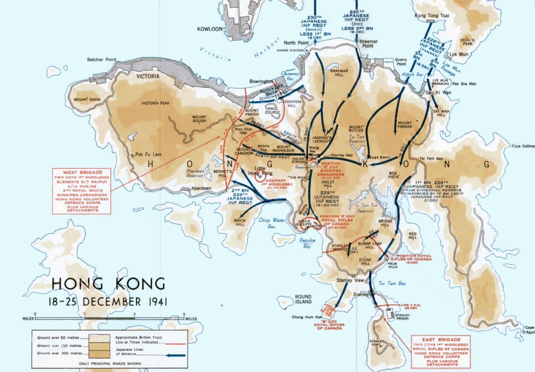
Description: Colour map of the Japanese invasion of Hong Kong, December 1941
Title: Hong Kong 18-25 December 1941
Credit: Stacey, C. P., maps drawn by C. C. J. Bond (1956) [1955]. Official History of the Canadian Army in the Second World War. Volume I: Six Year of War: The Army in Canada, Britain and the Pacific (PDF). (2nd rev. online ed.). Ottawa: By Authority of the Minister of National Defence. OCLC 917731527). Map compiled and drawn by Historical Section, General Staff, Canadian Army.
Author: C. C. J. Bond / Historical Section, General Staff, Canadian Army
Usage Terms: Public domain
License: Public domain
Attribution Required?: No
Image usage
The following page links to this image:

All content from Kiddle encyclopedia articles (including the article images and facts) can be freely used under Attribution-ShareAlike license, unless stated otherwise.