
Image: Hurricane Katrina LA landfall radar
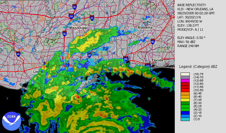
Description: Hurricane Katrina making its second landfall in Louisiana, as seen by NWS New Orleans radar.
Title: Hurricane Katrina LA landfall radar
Credit: Animation orginally located on the NCDC August 2005 (direct link).
Author: Radar data from NWS New Orleans and processed by the National Climatic Data Center.
Permission: This image is in the public domain because it contains materials that originally came from the U.S. National Oceanic and Atmospheric Administration, taken or made as part of an employee's official duties. Čeština | Deutsch | Zazaki | English | Español | Eesti | Suomi | Français | Magyar | Italiano | 日本語 | 한국어 | Македонски | മലയാളം | Plattdüütsch | Nederlands | Polski | Português | Română | Русский | Sicilianu | Slovenščina | Türkçe | 中文 | 中文(简体) | +/−
Usage Terms: Public domain
License: Public domain
Attribution Required?: No
Image usage
The following 3 pages link to this image:
