
Image: IVC Map
No higher resolution available.
IVC_Map.png (459 × 400 pixels, file size: 110 KB, MIME type: image/png)
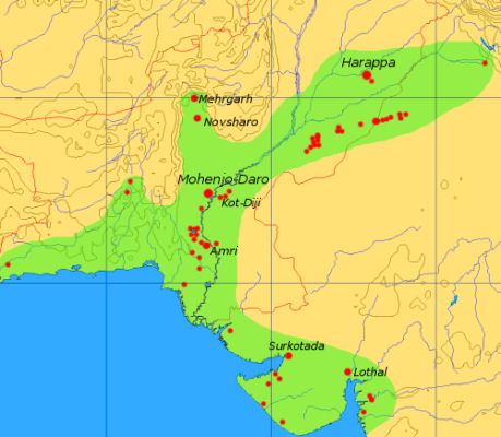
Description: This map is a provisional outline of the Indus Civilization based on online sources. It is the best GFDL map we have so far, but it should be redrawn with greater accuracy and proper source attribution.
Title: IVC Map
Credit: Own work
Author: Dbachmann (talk · contribs)
Usage Terms: Creative Commons Attribution-Share Alike 3.0
License: CC-BY-SA-3.0
License Link: http://creativecommons.org/licenses/by-sa/3.0/
Attribution Required?: Yes
Image usage
The following 3 pages link to this image:

All content from Kiddle encyclopedia articles (including the article images and facts) can be freely used under Attribution-ShareAlike license, unless stated otherwise.