
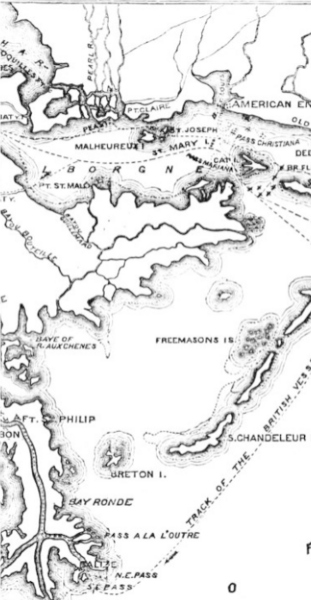
Image: Lake Borgne 1814

Size of this preview: 311 × 600 pixels. Other resolutions: 124 × 240 pixels | 363 × 700 pixels.
Original image (363 × 700 pixels, file size: 131 KB, MIME type: image/png)
Description: Pea Island is located at the mouth of the Pearl River, due north of St Malo. To the south west is Malheureux Point. In the bottom left, Fort St Philip is marked on the Plaquemines Bend of the Mississippi, with the Chandeleur Islands to the right.
Title: Lake Borgne 1814
Credit: The Pictorial Field Book of the War of 1812
Author: Benson Lossing
Usage Terms: Public domain
License: Public domain
Attribution Required?: No
Image usage
The following page links to this image:

All content from Kiddle encyclopedia articles (including the article images and facts) can be freely used under Attribution-ShareAlike license, unless stated otherwise.