
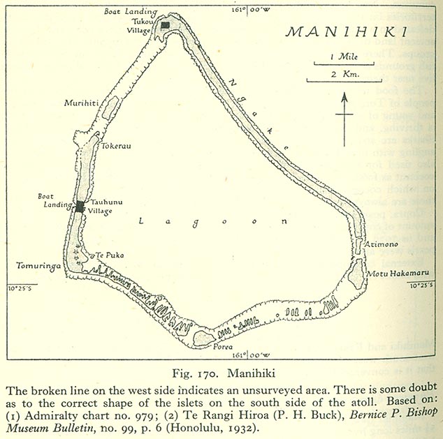
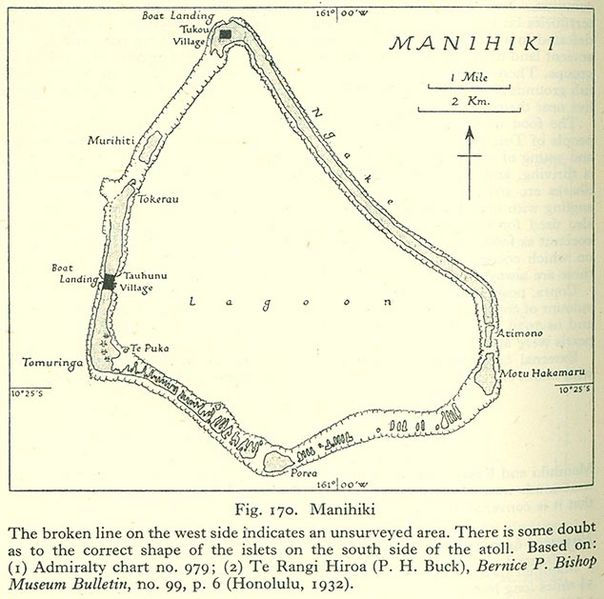
Image: Manihiki
Size of this preview: 604 × 599 pixels. Other resolutions: 242 × 240 pixels | 634 × 629 pixels.
Original image (634 × 629 pixels, file size: 98 KB, MIME type: image/jpeg)
Description: Map of Manihiki Atoll, Northern Cook Islands, Pacific Ocean
Title: Manihiki
Credit: http://www.lib.utexas.edu/maps/historical/pacific_islands_1943_1945/manihiki.jpg
Author: US Army
Usage Terms: Public domain
License: Public domain
Attribution Required?: No
Image usage
The following page links to this image:

All content from Kiddle encyclopedia articles (including the article images and facts) can be freely used under Attribution-ShareAlike license, unless stated otherwise.