
Image: Map of Bangladesh-en

Size of this PNG preview of this SVG file: 485 × 599 pixels. Other resolution: 194 × 240 pixels.
Original image (SVG file, nominally 1,678 × 2,074 pixels, file size: 3.86 MB)
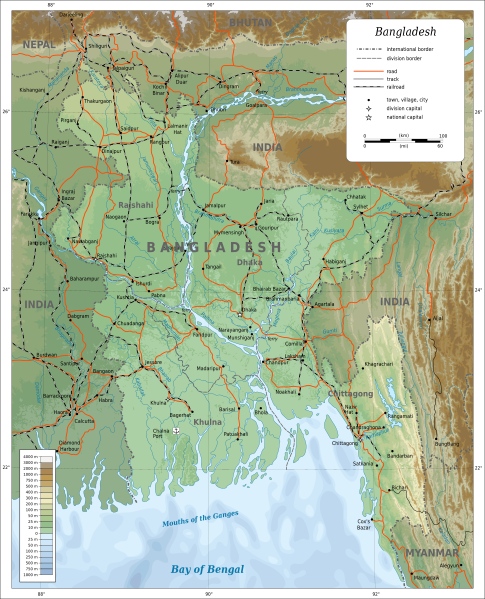
Description: Topographic map of Bangladesh. Lambert Conformal Conic projection, standard parallels 22°N/26°N, center longitude 90°E.
Author: Oona Räisänen (Mysid)
Usage Terms: Creative Commons Attribution-Share Alike 3.0
License: CC-BY-SA-3.0
License Link: http://creativecommons.org/licenses/by-sa/3.0/
Attribution Required?: Yes
Image usage
The following page links to this image:

All content from Kiddle encyclopedia articles (including the article images and facts) can be freely used under Attribution-ShareAlike license, unless stated otherwise.