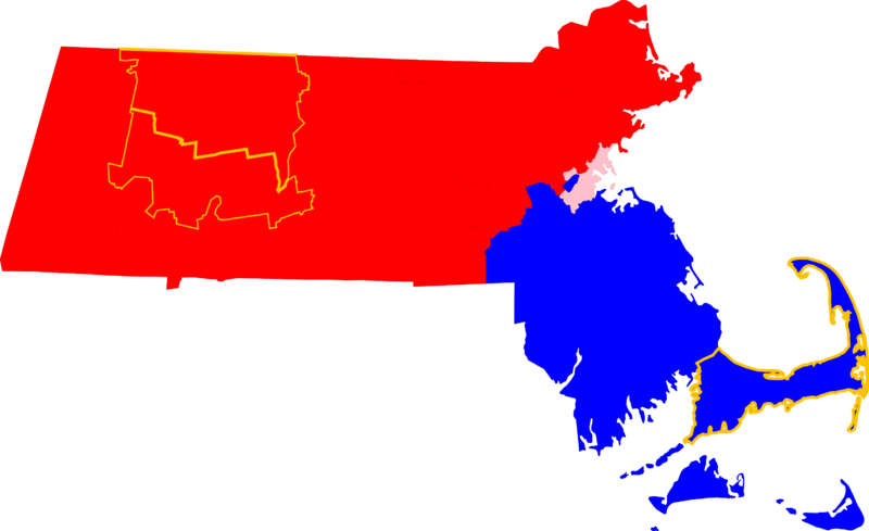
Image: Map of Massachusetts Counties by Local County Government

Size of this PNG preview of this SVG file: 800 × 489 pixels. Other resolution: 320 × 196 pixels.
Original image (SVG file, nominally 2,976 × 1,819 pixels, file size: 43 KB)
Description: A map of Massachusetts showing the different statuses of local government at the county level. Key: Red - County government abolished or disincorporated Pink - County government role operated by a municipality (not city-county consolidation). Blue - Current county government Gold outline - County regional compacts to serve as a form of regional governance
Title: Map of Massachusetts Counties by Local County Government
Credit: Based on File:Map_of_Massachusetts_highlighting_Barnstable_County.svg
Author: Based on map by User:David Benbennick
Usage Terms: Public domain
License: Public domain
Attribution Required?: No
Image usage
The following page links to this image:

All content from Kiddle encyclopedia articles (including the article images and facts) can be freely used under Attribution-ShareAlike license, unless stated otherwise.
