
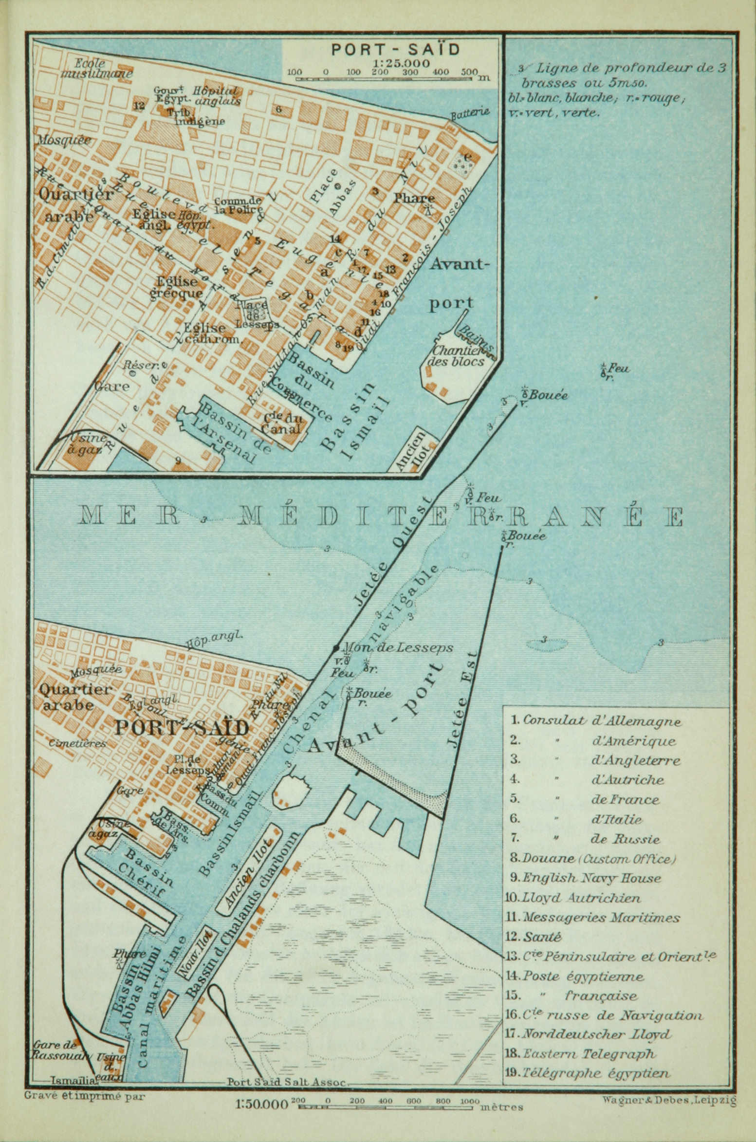
Image: Map of Port Said (Baedeker, 1914)
Size of this preview: 397 × 600 pixels. Other resolutions: 159 × 240 pixels | 1,553 × 2,346 pixels.
Original image (1,553 × 2,346 pixels, file size: 3.32 MB, MIME type: image/jpeg)
Description: Map of Port Said and environs, esp. the port facilities (1:50,000), with an inserted smaller map of the actual city (1:25,000); labelled in French.
Title: Map of Port Said (Baedeker, 1914)
Credit: Original publication: Indien. Handbuch für Reisende. Verlag Karl Baedeker, Leipzig, 1914, p. 4 f. Immediate source: https://baedeker.acdh.oeaw.ac.at/images/baedeker.3d41d/Baedeker-Indien_n0004_a.jpg
Author: Karl Baedeker (Life time: 1827-1859)
Usage Terms: Public domain
License: Public domain
Attribution Required?: No
Image usage
The following page links to this image:

All content from Kiddle encyclopedia articles (including the article images and facts) can be freely used under Attribution-ShareAlike license, unless stated otherwise.
.jpg)