
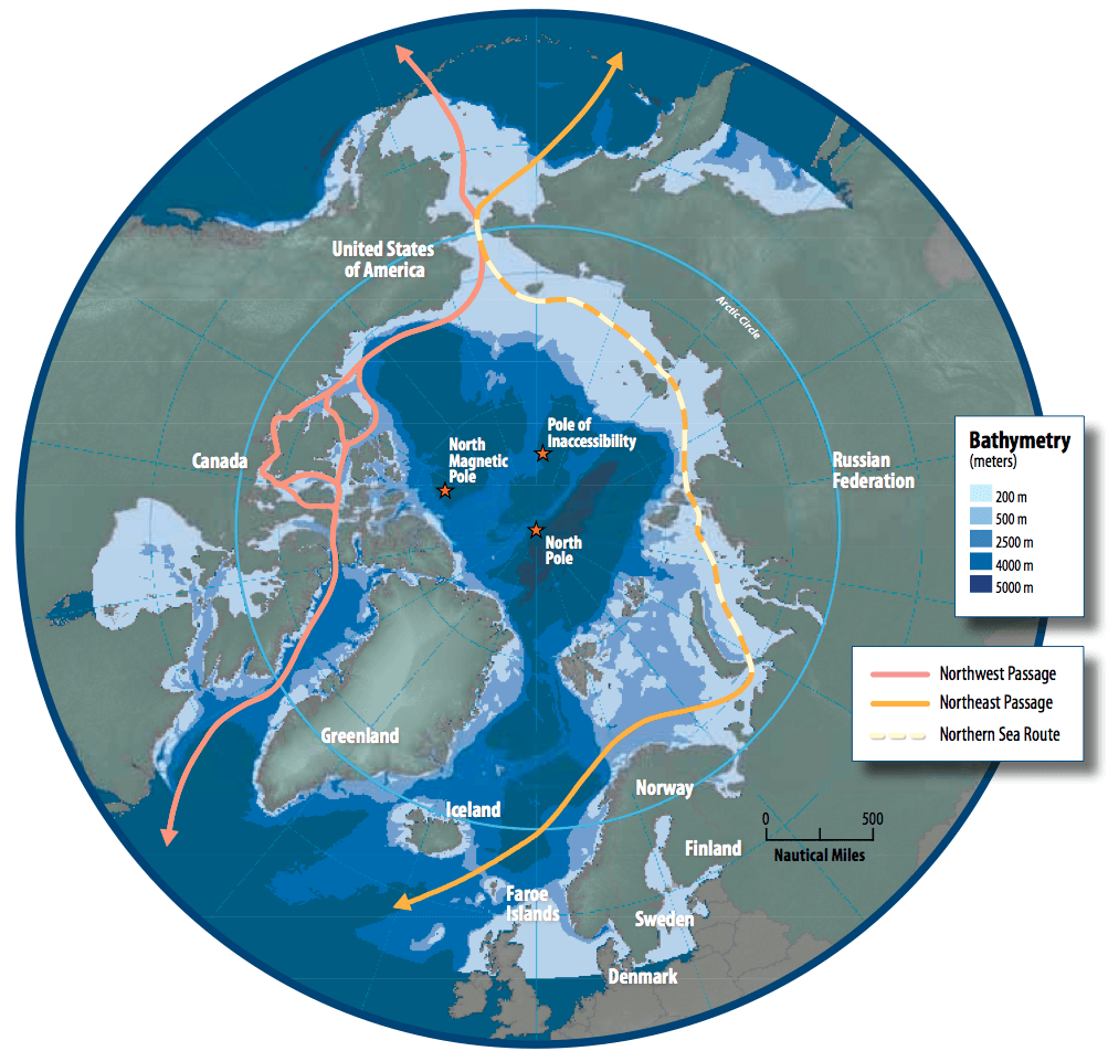
Image: Map of the Arctic region showing the Northeast Passage, the Northern Sea Route and Northwest Passage, and bathymetry
Size of this preview: 632 × 600 pixels. Other resolutions: 253 × 240 pixels | 1,003 × 952 pixels.
Original image (1,003 × 952 pixels, file size: 758 KB, MIME type: image/png)
Description: Map of the Arctic region showing shipping routes Northeast Passage, Northern Sea Route, and Northwest Passage, and bathymetry
Title: Map of the Arctic region showing the Northeast Passage, the Northern Sea Route and Northwest Passage, and bathymetry
Credit: Arctic Council - Arctic marine shipping assessment - http://www.arctic.noaa.gov/detect/documents/AMSA_2009_Report_2nd_print.pdf
Author: Susie Harder
Usage Terms: Public domain
License: Public domain
Attribution Required?: No
Image usage
The following 5 pages link to this image:

All content from Kiddle encyclopedia articles (including the article images and facts) can be freely used under Attribution-ShareAlike license, unless stated otherwise.