
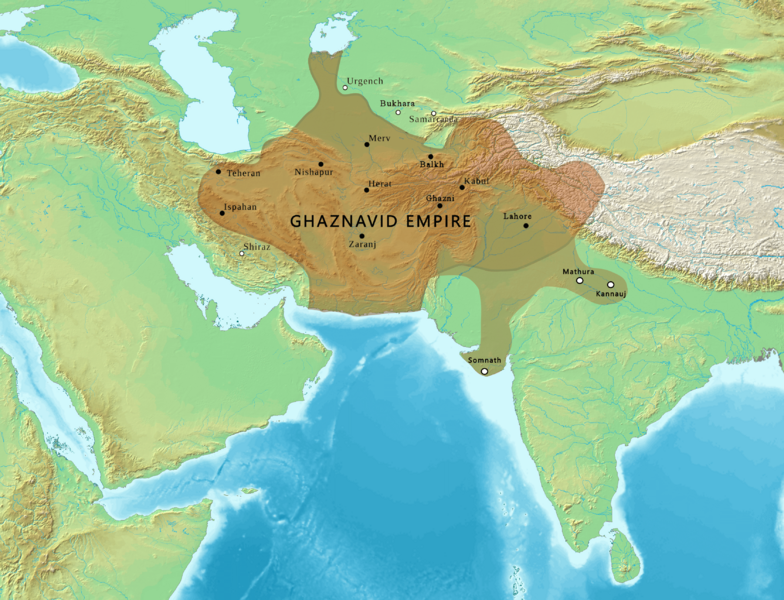
Image: Map of the Ghaznavid Empire

Size of this preview: 784 × 600 pixels. Other resolutions: 314 × 240 pixels | 3,367 × 2,575 pixels.
Original image (3,367 × 2,575 pixels, file size: 3.76 MB, MIME type: image/png)
Description: Map of the Ghaznavid Empire
Title: Map of the Ghaznavid Empire
Credit: This file has been extracted from another file
Author: Map created from DEMIS Mapserver, which are public domain. Koba-chan. Ghaznavid Empire 975 - 1187 (AD).PNG: Arab League Khwarezmian Empire 1190 - 1220 (AD).svg: Rcsprinter123 derivative work: Rowanwindwhistler Reference: [1]
Usage Terms: Creative Commons Attribution 4.0
License: CC BY 4.0
License Link: https://creativecommons.org/licenses/by/4.0
Attribution Required?: Yes
Image usage
The following 3 pages link to this image:

All content from Kiddle encyclopedia articles (including the article images and facts) can be freely used under Attribution-ShareAlike license, unless stated otherwise.