
Image: Map of the Kingdom of Lydia
Size of this preview: 787 × 600 pixels. Other resolutions: 315 × 240 pixels | 2,456 × 1,871 pixels.
Original image (2,456 × 1,871 pixels, file size: 340 KB, MIME type: image/png)
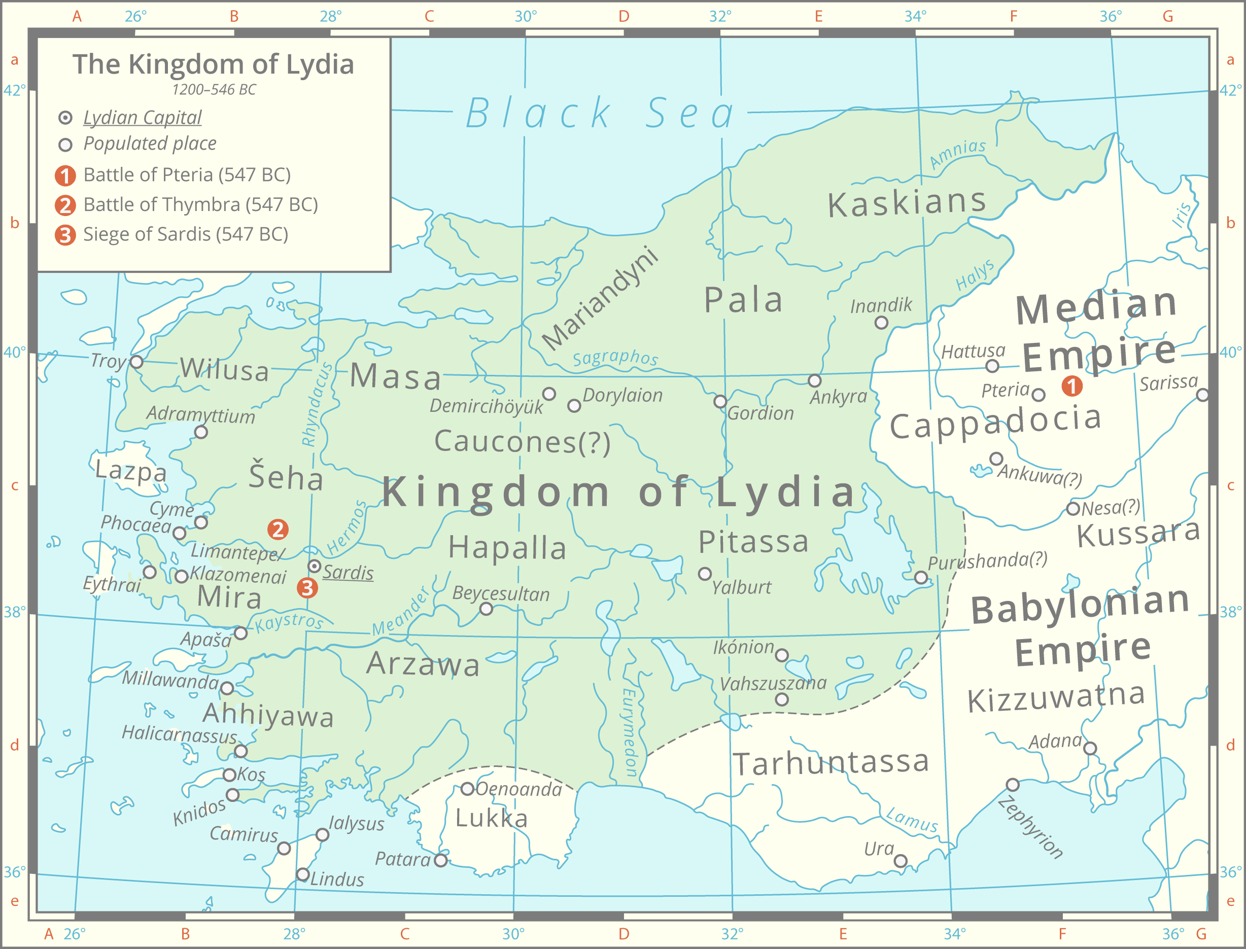
Description: A map depicting the ancient Kingdom of Lydia with the locations of its three last battles against the Persians highlighted. Historical lakes and coastlines are derived from the Ancient World Mapping Center [1]. The political borders are based upon this map [2]
Title: Map of the Kingdom of Lydia
Credit: Own work
Author: Cattette
Usage Terms: Creative Commons Attribution 4.0
License: CC BY 4.0
License Link: https://creativecommons.org/licenses/by/4.0
Attribution Required?: Yes
Image usage
The following 2 pages link to this image:

All content from Kiddle encyclopedia articles (including the article images and facts) can be freely used under Attribution-ShareAlike license, unless stated otherwise.