
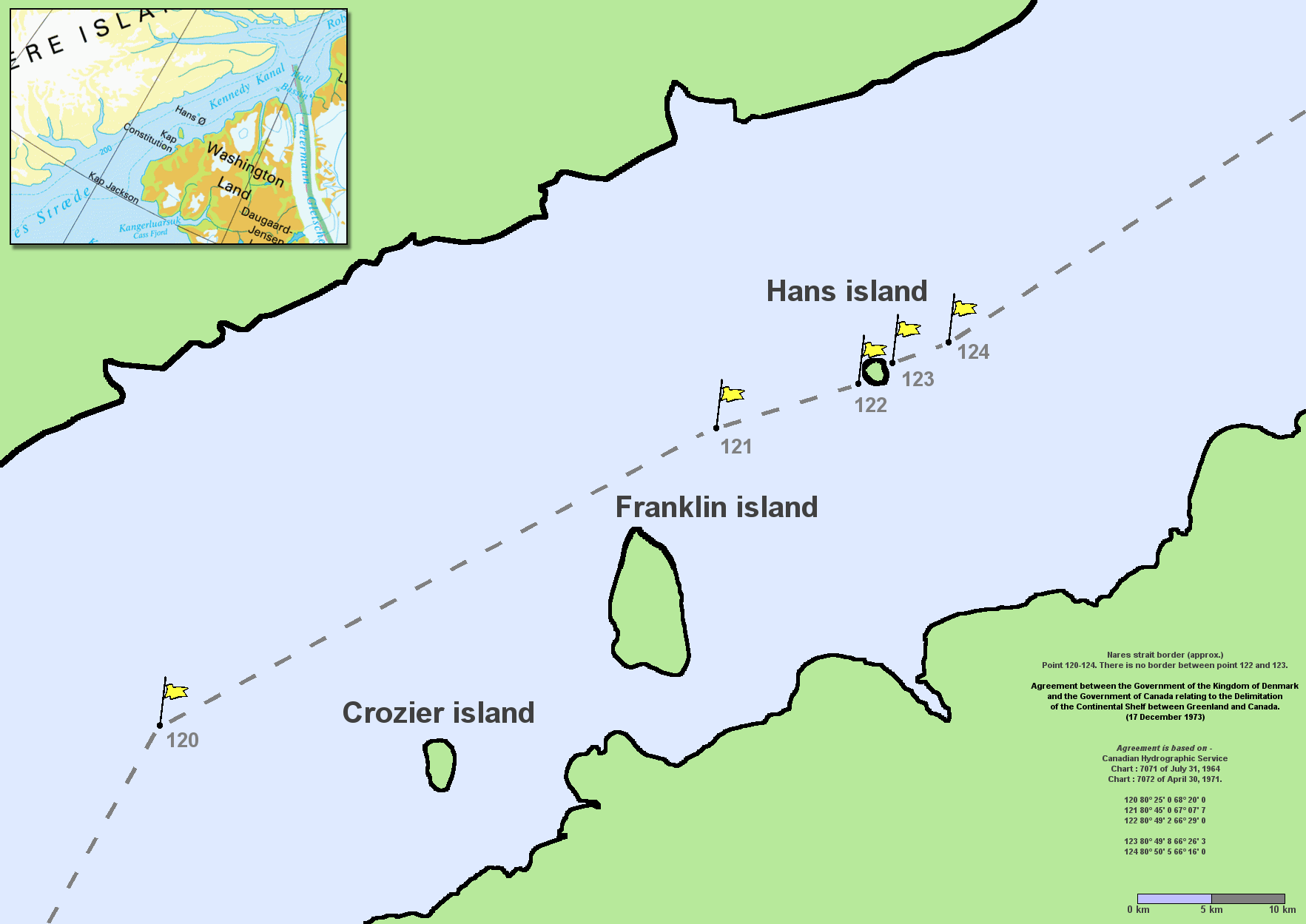
Image: Nares strait border (Kennedy channel)
Description: en:Nares Strait (en:Kennedy Channel) border (approx.) Point 120–124. There is no border between point 122 and 123. Agreement between the Government of the Kingdom of Denmark and the Government of Canada relating to the Delimitation of the Continental Shelf between Greenland and Canada. (17 December 1973) Agreement is based on en:Canadian Hydrographic Service charts 7071 of July 31, 1964 and 7072 of April 30, 1971 120 80° 25′ 0 68° 20′ 0 121 80° 45′ 0 67° 07′ 7 122 80° 49′ 2 66° 29′ 0 123 80° 49′ 8 66° 26′ 3 124 80° 50′ 5 66° 16′ 0 By Lasse Jensen, July 29, 2005 The copyright holder of this file allows anyone to use it for any purpose, provided that it is reproduced accurately and not used in a misleading context, credit is given and copyright is attributed.. Usage notes: • If the work requires attribution, use instead • If this is your own work, please use Template:Cc-zero instead Please check that the conditions given above are compliant to the Commons licensing policy. Most importantly, derivative work and commercial use must be allowed. Copyrighted free use//commons.wikimedia.org/wiki/File:Nares_strait_border_(Kennedy_channel).png
Title: Nares strait border (Kennedy channel)
Author: User Twthmoses on en.wikipedia
Usage Terms: Copyrighted free use
License: Copyrighted free use
License Link: //commons.wikimedia.org/wiki/File:Nares_strait_border_(Kennedy_channel).png
Image usage
The following 3 pages link to this image:

.png)