
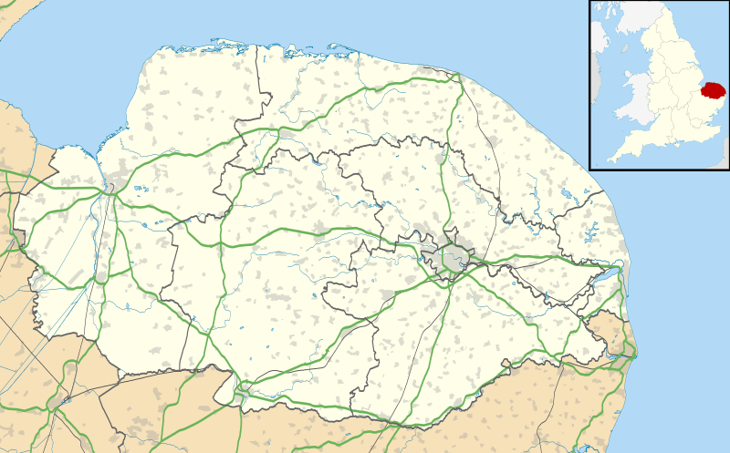
Image: Norfolk UK location map

Description: Map of Norfolk, UK with the following information shown: Administrative borders Coastline, lakes and rivers Roads and railways Urban areas Equirectangular map projection on WGS 84 datum, with N/S stretched 160% Geographic limits: West: 0.12E East: 2.00E North: 53.05N South: 52.32N
Title: Norfolk UK location map
Credit: Ordnance Survey OpenData. Administrative borders and coastline data from Boundary-Line product. All other geographic data from Meridian 2 product. Inset derived from England location map.svg by Spischot.
Author: Nilfanion, created using Ordnance Survey data
Permission: This file is licensed under the Creative Commons Attribution-Share Alike 3.0 Unported license. Attribution: Contains Ordnance Survey data © Crown copyright and database right You are free: to share – to copy, distribute and transmit the work to remix – to adapt the work Under the following conditions: attribution – You must attribute the work in the manner specified by the author or licensor (but not in any way that suggests that they endorse you or your use of the work). share alike – If you alter, transform, or build upon this work, you may distribute the resulting work only under the same or similar license to this one. http://creativecommons.org/licenses/by-sa/3.0 CC BY-SA 3.0 Creative Commons Attribution-Share Alike 3.0 truetrue
Usage Terms: Creative Commons Attribution-Share Alike 3.0
License: CC BY-SA 3.0
License Link: http://creativecommons.org/licenses/by-sa/3.0
Attribution Required?: Yes
Image usage
More than 100 pages link to this image. The following list shows the first 100 page links to this image only. A full list is available.
- Acle
- Alethorpe
- Arminghall
- Attleborough
- Aylsham
- Babingley
- Baconsthorpe Castle
- Basilica of Our Lady of Walsingham
- Bethel Street drill hall
- Bixley
- Blakeney Point
- Brampton, Norfolk
- Branodunum
- Buckenham Castle
- Burgh Castle
- Burgh Castle (Roman fortification)
- Caister-on-Sea
- Caister Roman Site
- Castle Acre Castle and town walls
- Castle Acre Priory
- Castle Rising Castle
- Cattle Market Street drill hall, Norwich
- Chapel Field Road drill hall, Norwich
- Church of St Michael, Aylsham
- Claxton Castle
- Cley next the Sea
- Cow Tower, Norwich
- Cromer
- Denton Castle
- Dereham
- Dilham Castle
- Diss
- Docking, Norfolk
- Downham Market
- Ellingham, Norfolk
- Fakenham
- Gariannonum
- Godwick
- Gorleston-on-Sea
- Great Yarmouth
- Gresham Castle
- Hemblington
- Hempton Priory
- Hemsby
- Hethel
- Hingham, Norfolk
- Holkham Camp
- Holkham National Nature Reserve
- Holt, Norfolk
- Hopton-on-Sea
- Horsford Castle
- Horsham St Faith
- Hunstanton
- King's Lynn
- Kirby Cane
- Langford, Norfolk
- Leziate
- Loddon, Norfolk
- Middleton Mount
- North Elmham Castle
- North Walsham
- Norwich Airport
- Priory of St Mary in the Meadow, Beeston Regis
- Quidenham
- RAF Narborough
- Redenhall with Harleston
- Reepham, Norfolk
- Salle, Norfolk
- Sandringham, Norfolk
- Scolt Head Island
- Sheringham
- Southrepps
- Spring Beck
- Sprowston
- St Andrew's Church, Hempstead
- St Benet's Abbey
- St Dominic, Downham Market
- St Margaret's, Cley
- St Margaret's Church, Felbrigg
- St Mary's Church, Islington, Norfolk
- St Mary Magdalene Church, Sandringham
- St Mary the Virgin's Church, Great Bircham
- St Nicholas, Blakeney
- St Peter Mancroft
- St Peter and St Paul, East Harling
- Stalham
- Stanford Training Area
- Swaffham
- Thetford
- Thetford Castle
- Thorpe St Andrew
- Titchwell Marsh
- Upton, Norfolk
- Walcott, Norfolk
- Walsingham
- Watton, Norfolk
- Weeting Castle
- Wells-next-the-Sea
- Weybourne, Norfolk
- Wormegay Castle
