
Image: Planning Regions of Connecticut
Size of this preview: 800 × 571 pixels. Other resolutions: 320 × 229 pixels | 2,268 × 1,620 pixels.
Original image (2,268 × 1,620 pixels, file size: 187 KB, MIME type: image/png)
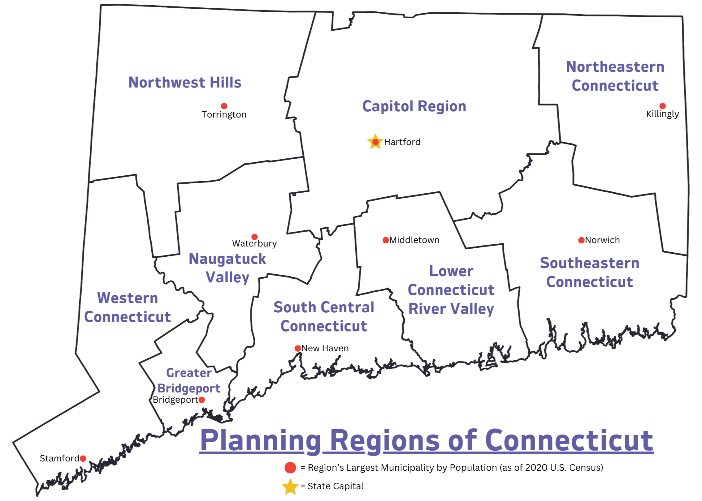
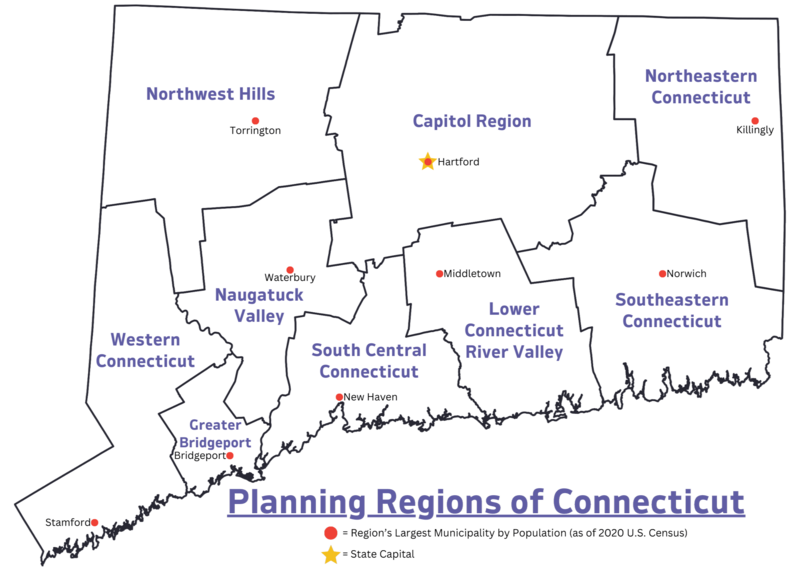
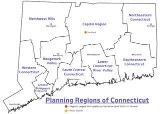
Description: Map displays the official Planning Regions of Connecticut, and the largest municipality in each region by population (as of the 2020 United States Census)
Title: Planning Regions of Connecticut
Credit: Own work
Author: AirportExpert
Usage Terms: Creative Commons Zero, Public Domain Dedication
License: CC0
License Link: http://creativecommons.org/publicdomain/zero/1.0/deed.en
Attribution Required?: No
Image usage
The following page links to this image:

All content from Kiddle encyclopedia articles (including the article images and facts) can be freely used under Attribution-ShareAlike license, unless stated otherwise.