
Image: Political map of Canada

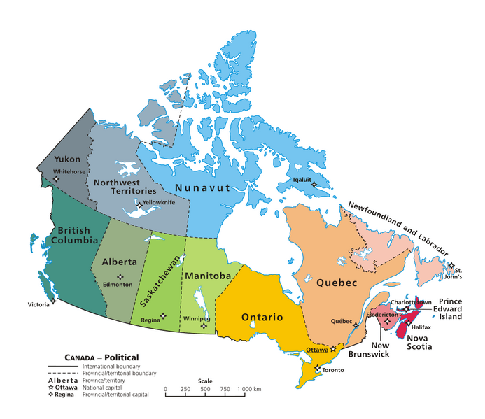
Description: A map of Canada exhibiting its ten provinces and three territories, and their capitals. (Lambert conformal conic projection from The Atlas of Canada)
Title: Political map of Canada
Credit: Own work
Author: E Pluribus Anthony, transferred to Wikimedia Commons by Kaveh (log), optimized by Andrew pmk.
Permission: This work has been released into the public domain by its author, E Pluribus Anthony at the English Wikipedia project. This applies worldwide. In case this is not legally possible: E Pluribus Anthony grants anyone the right to use this work for any purpose, without any conditions, unless such conditions are required by law.
Usage Terms: Public domain
License: Public domain
Attribution Required?: No
Image usage
The following 4 pages link to this image:
