
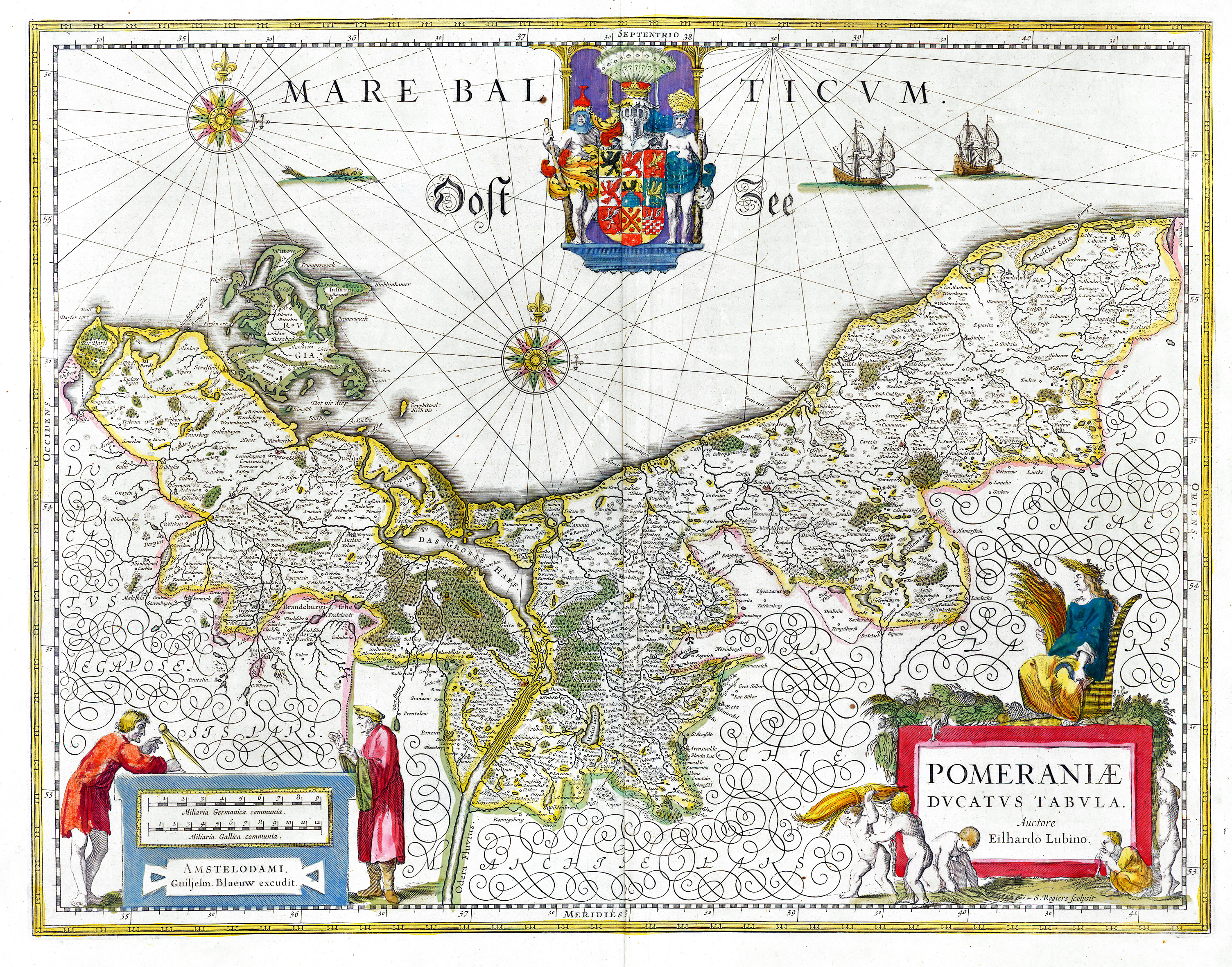
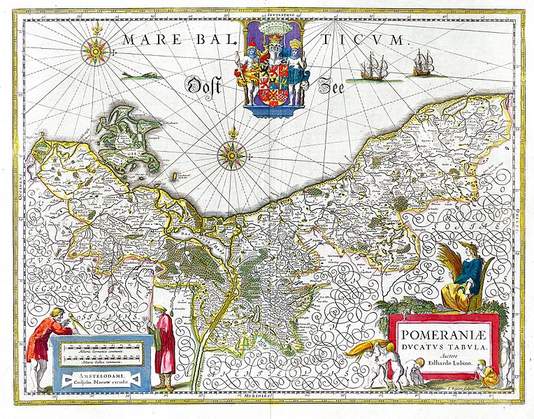
Image: Pomeraniae Ducatus Tabula
Size of this preview: 764 × 600 pixels. Other resolutions: 306 × 240 pixels | 3,009 × 2,363 pixels.
Original image (3,009 × 2,363 pixels, file size: 3.09 MB, MIME type: image/jpeg)
Description: Map of the historical Duchy of Pomerania from the 17th century
Title: Pomeraniae Ducatus Tabula
Credit: Willem & Joan Blaeu, Atlas Blaeu (later Atlas Maior), 1662
Author: Eilhard Lubinus
Permission: PD-Old
Usage Terms: Public domain
License: Public domain
Attribution Required?: No
Image usage
The following 6 pages link to this image:

All content from Kiddle encyclopedia articles (including the article images and facts) can be freely used under Attribution-ShareAlike license, unless stated otherwise.