
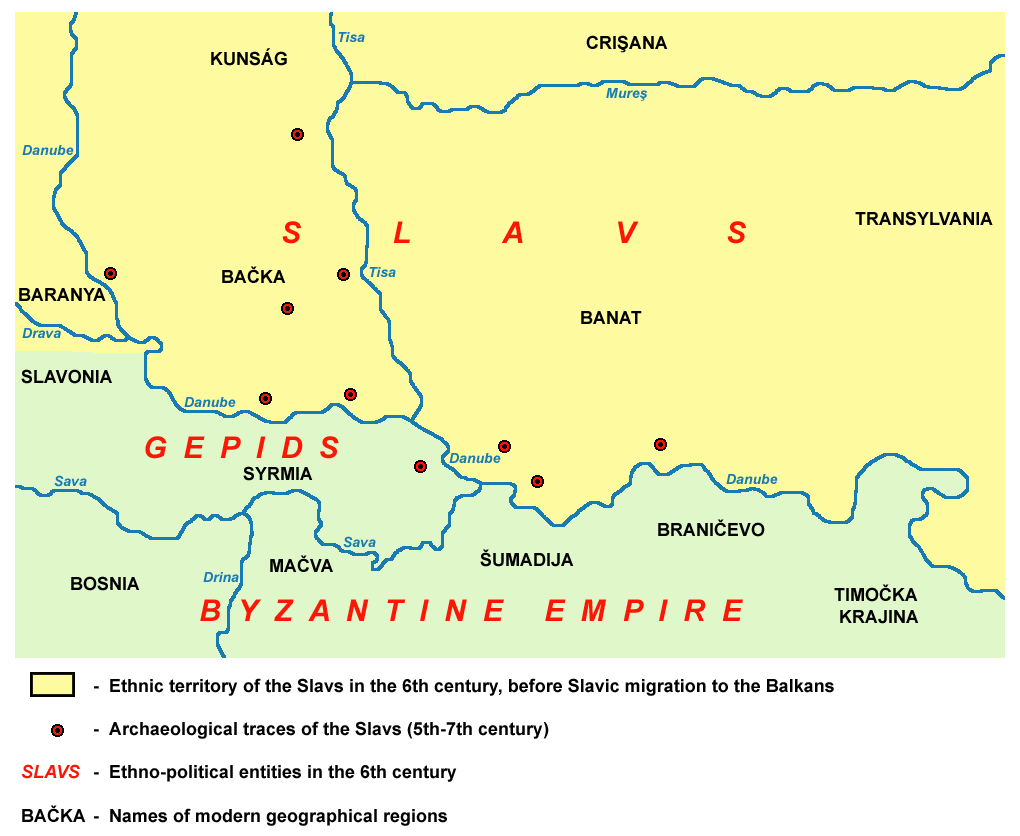
Image: Slavs Vojvodina01 map
Size of this preview: 732 × 600 pixels. Other resolutions: 293 × 240 pixels | 1,020 × 836 pixels.
Original image (1,020 × 836 pixels, file size: 69 KB, MIME type: image/png)
Description: historical map of old Slavs in Vojvodina (Banat, Bačka and Syrmia) in the 6th century, before Slavic migration to the Balkans.
Title: Slavs Vojvodina01 map
Credit: No machine-readable source provided. Own work assumed (based on copyright claims).
Author: No machine-readable author provided. PANONIAN assumed (based on copyright claims).
Usage Terms: Public domain
License: Public domain
Attribution Required?: No
Image usage

All content from Kiddle encyclopedia articles (including the article images and facts) can be freely used under Attribution-ShareAlike license, unless stated otherwise.