
Image: ThreeGorgesDam-Landsat7
Size of this preview: 459 × 599 pixels. Other resolutions: 184 × 240 pixels | 540 × 705 pixels.
Original image (540 × 705 pixels, file size: 197 KB, MIME type: image/jpeg)
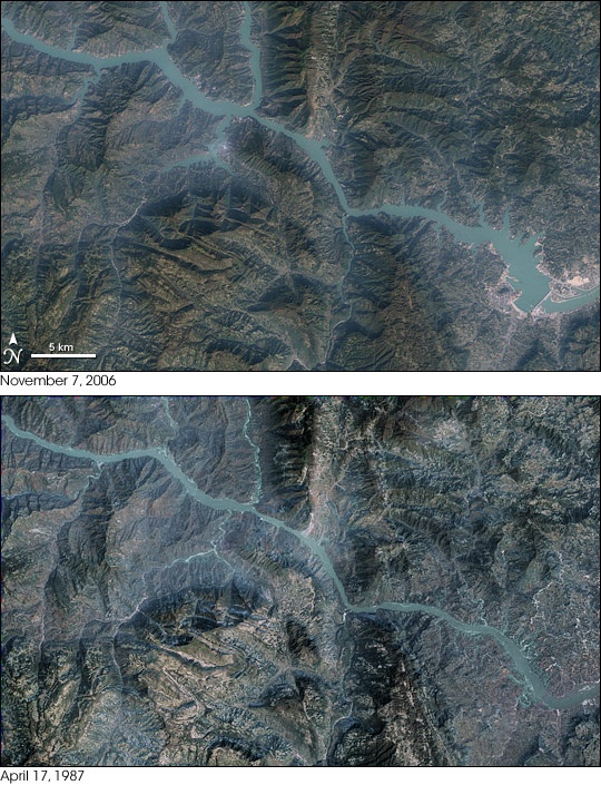
Description: These images show the Yangtze River in the vicinity of the Three Gorges Dam (lower right). Landsat 7 acquired the top image on November 7, 2006, after the main wall was complete. Landsat 5 acquired the bottom image on April 17, 1987. The lower image has been recolored to more closely match the colors of the upper one.
Title: ThreeGorgesDam-Landsat7
Credit: Transferred from en.wikipedia to Commons by Rehman using CommonsHelper.
Author: The original uploader was Sagredo at English Wikipedia
Usage Terms: Public domain
License: Public domain
Attribution Required?: No
Image usage
The following 3 pages link to this image:

All content from Kiddle encyclopedia articles (including the article images and facts) can be freely used under Attribution-ShareAlike license, unless stated otherwise.