
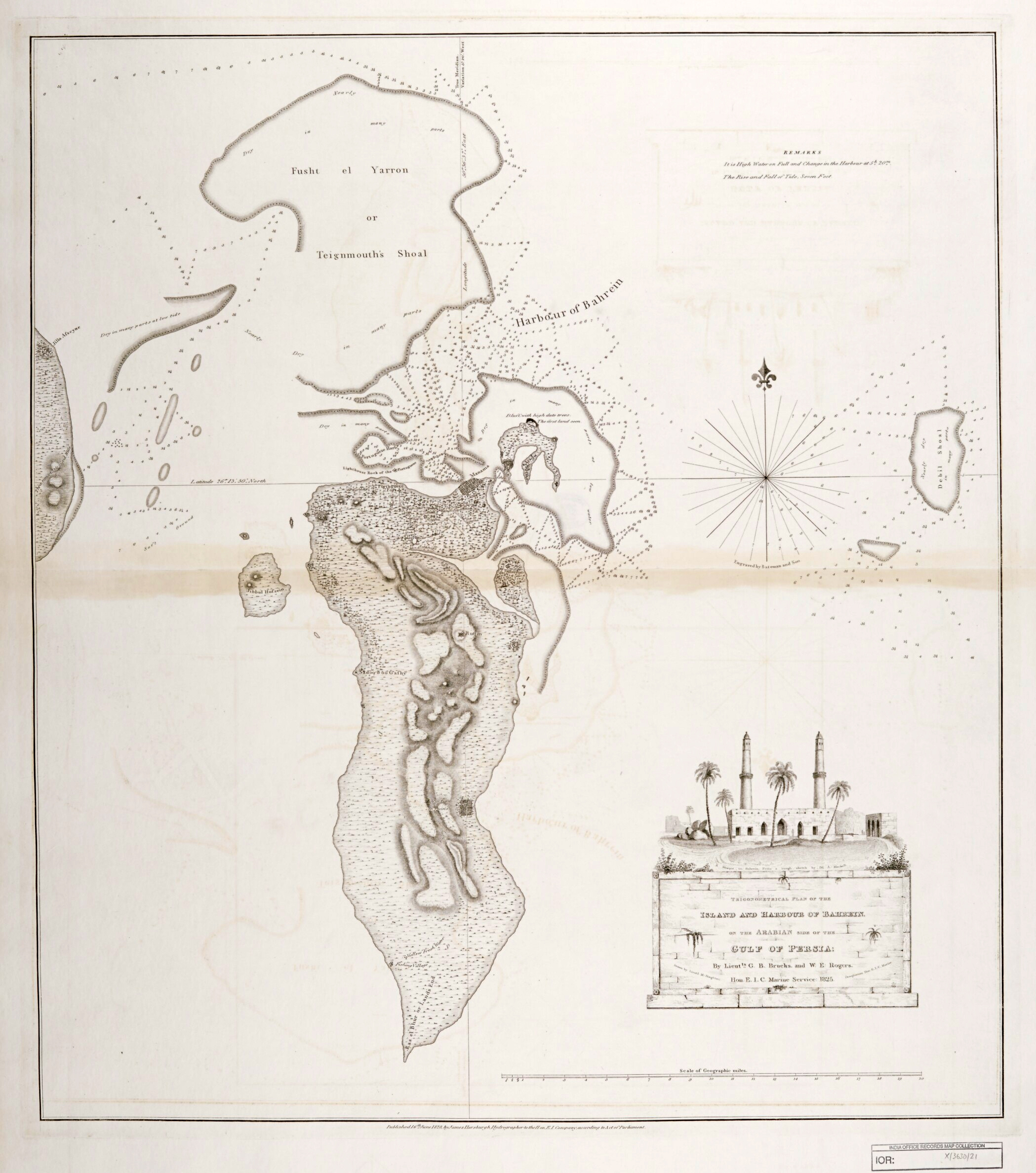
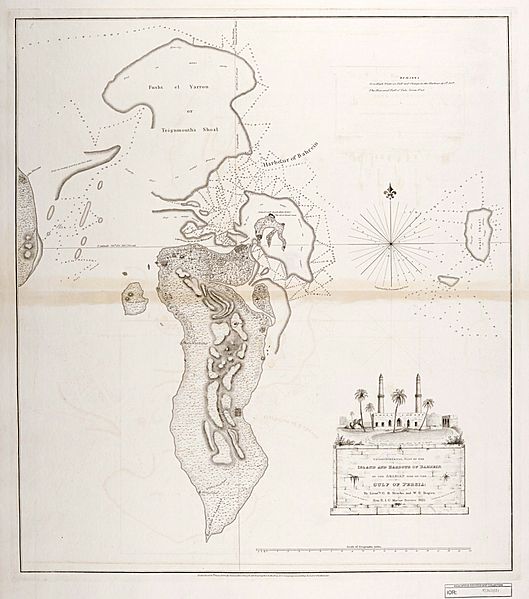
Image: Trigonometrical Plan of the Island and Harbour of Bahrain
Size of this preview: 529 × 599 pixels. Other resolutions: 212 × 240 pixels | 2,098 × 2,376 pixels.
Original image (2,098 × 2,376 pixels, file size: 1.8 MB, MIME type: image/jpeg)
Description: "‘Trigonometrical Plan of the Island and Harbour of Bahrein, on the Arabian Side of the Gulf of Persia; by Lieutts. G.B. Brucks, and W.E. Rogers. Hon. E.I.C. Marine Service: 1825. Drawn by Lieutt. M. Houghton; Draughtsman Hon. E.I.C. Marine. Engraved by Bateman and Son’"
Title: Trigonometrical Plan of the Island and Harbour of Bahrain
Credit: Qatar Digital Library
Author: by Lieutts. G.B. Brucks, and W.E. Rogers. Hon. E.I.C. Marine Service: 1825. Drawn by Lieutt. M. Houghton; Draughtsman Hon. E.I.C. Marine
Usage Terms: Open Government License version 1.0
License: OGL v1.0
License Link: http://NationalArchives.gov.uk/doc/open-government-licence/version/1/
Attribution Required?: Yes
Image usage
The following page links to this image:

All content from Kiddle encyclopedia articles (including the article images and facts) can be freely used under Attribution-ShareAlike license, unless stated otherwise.