
Johor Bahru facts for kids
Quick facts for kids
Johor Bahru
|
|
|---|---|
| Bandaraya Johor Bahru | |

Clockwise from top left: Night view of Johor Bahru, Sultan Ibrahim Building, Tebrau Highway & Johor–Singapore Causeway
|
|
| Nickname(s):
JB,
Bandaraya Selatan (Southern City) |
|
| Motto(s):
Berkhidmat, Berbudaya, Berwawasan
(English: "Servicing, Cultured, Visionary") |
|

Johor Bahru
Location in Peninsular Malaysia
|
|
| Country | |
| State | |
| Administrative Areas |
List
|
| Establishment | 10 March 1855 (as Tanjung Puteri) |
| Granted city status | 1 January 1994 |
| Founded by | Temenggong Daeng Ibrahim |
| Area | |
| • Total | 185 km2 (71 sq mi) |
| Elevation | 36.88 m (121.00 ft) |
| Population
(2010)
|
|
| • Total | 1,334,188 |
| • Density | 7,409/km2 (19,190/sq mi) |
| Time zone | UTC+8 (MST) |
| • Summer (DST) | Not observed |
Johor Bahru (also spelled Johor Baharu, Johor Baru, or Johore Bahru; shortly as JB) is the capital city of Johor, Malaysia. Pasir Pelangi, the royal village, is located in Johor Bahru.
The city in itself has a population of 1,334,188 as of 2010. The metropolitan area of Johor Bahru, also known as Iskandar Malaysia, has a population of 1,730,000.
Images for kids
-
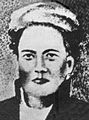
Temenggong Daeng Ibrahim, founder of Tanjung Puteri, which he renamed Iskandar Puteri (present-day Johor Bahru)
-
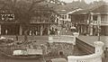
Segget River at the junction of Wong Ah Fook Street and Ungku Puan Street in Johor Bahru, c. 1920.
-
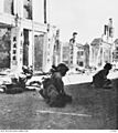
Japanese troops crouch in the street of Johor Bahru in the final stages of the Battle of Malaya to conquer Singapore: image taken on 31 January 1942.
-
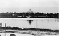
A view of the causeway, after being blown up by Allied forces as a final action to counter the Japanese advance
-
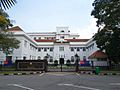
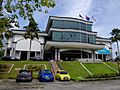
Johor Bahru City Council
-
Johor Bahru High Court
-
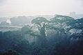
Tropical rainforest near the city, features an equatorial climate.
-
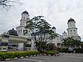
Sultan Abu Bakar State Mosque, the main mosque in the city.
-
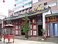
Johor Bahru Old Chinese Temple, the main Chinese temple in the city.
-
Persada Johor International Convention Centre
-
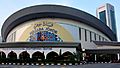
Johor Bahru Sentral on the left with the highway in the right.
-
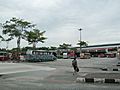
Larkin Sentral bus terminal
-
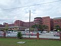
Sultanah Aminah Hospital
-
Johor Public Library
-
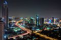
Johor Bahru at night skyline
-
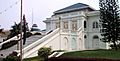
The Grand Palace, one of the historical buildings in the city.
-
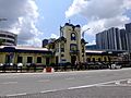
The Johor Bahru railway station, served for 100 years before being replaced by the new Johor Bahru Sentral; it has now been transformed into a museum.
-
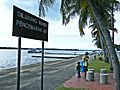
Parts of the Danga Bay recreational park.
-
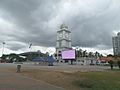
Dataran Bandaraya
-
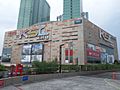
KSL City Mall
-
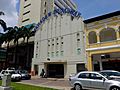
Broadway Theatre
-
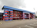
Tan Sri Dato' Haji Hassan Yunos Stadium


.JPG)


.jpg)


.jpg)

See also
 In Spanish: Johor Bahru para niños
