Mallorys Creek (Little Nottoway River tributary) facts for kids
Quick facts for kids Mallorys Creek |
|
|---|---|
| Other name(s) | Tributary to the Little Nottoway River |
| Country | United States |
| State | Virginia |
| County | Nottoway |
| Town | Burkeville |
| Physical characteristics | |
| Main source | divide between Little Nottoway River and Sandy River (Appomattox River) Burkes Tavern, Virginia 555 ft (169 m) 37°08′31″N 078°08′59″W / 37.14194°N 78.14972°W |
| River mouth | Little Nottoway River about 2 miles southwest of Crewe, Virginia 335 ft (102 m) 37°08′31″N 078°08′59″W / 37.14194°N 78.14972°W |
| Length | 6.13 mi (9.87 km) |
| Basin features | |
| Progression | southeast |
| River system | Nottoway River |
| Basin size | 7.10 square miles (18.4 km2) |
| Tributaries |
|
| Bridges | US 360 Lewiston Plank Road Lone Pine Road |
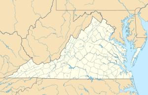
The Mallorys Creek is a 7.10 mi (11.43 km) long tributary to the Little Nottoway River in the United States state of Virginia. Located in the south-central part of the state, it is part of the larger Chowan-Albemarle drainage. The watershed is 54% forested and 39% agricultural with the rest of land as other uses. This stream joins with Carys Creek to form the Little Nottoway River.

All content from Kiddle encyclopedia articles (including the article images and facts) can be freely used under Attribution-ShareAlike license, unless stated otherwise. Cite this article:
Mallorys Creek (Little Nottoway River tributary) Facts for Kids. Kiddle Encyclopedia.

