
Andalusia facts for kids
Quick facts for kids Andalusia (Andalucía) |
|||
| Autonomous community (Comunidad autónoma) | |||
|
|||
| Official name: Comunidad Autónoma de Andalucía | |||
| Motto: Andalucía por sí, para España y la humanidad |
|||
| Country | |||
|---|---|---|---|
| Region | Iberian Peninsula | ||
| Capital and largest city | Seville | ||
| - center | Lower Andalusia | ||
| - elevation | 7 m (23 ft) | ||
| - coordinates | 37°22′0″N 5°58′0″W / 37.36667°N 5.96667°W | ||
| Highest point | Mulhacén | ||
| - location | Sierra Nevada, Cordillera Penibética, |
||
| - elevation | 3,285 m (10,778 ft) | ||
| - coordinates | 37°03′12″N 3°18′41″W / 37.05333°N 3.31139°W | ||
| Lowest point | Sea level | ||
| - location | Mediterranean Sea | ||
| - elevation | 0 m (0 ft) | ||
| Area | 87,268 km² (33,694 sq mi) | ||
| Population | 8,449,985 (2012) | ||
| Density | 97 /km² (251 /sq mi) | ||
| Statute of Autonomy | 30 December 1981 first revision 2002 second revision 2007 |
||
| President | Susana Díaz (PSOE) | ||
| Timezone | CET (UTC+1) | ||
| - summer (DST) | CEST (UTC+2) | ||
| ISO 3166-2 code | ES-AN | ||
| Demonym | Andalusian Spanish: Andaluz (za) |
||
| Anthem | Himno de Andalucía | ||
| Currency | Euro (€) | ||
| Date format | dd-mm-yyyy | ||
| Drive | right-side | ||

.svg)
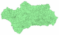
Andalusia (Spanish: Andalucía) is the first in population among the 17 Autonomous communities in Spain and the second, after Castile and León, in area. The territory is divided into eight provinces: Almería, Cádiz, Córdoba, Granada, Huelva, Jaén, Málaga and Seville. Its capital is the city of Seville (Spanish: Sevilla).
Andalusia is in the south of the Iberian peninsula, just to the south of the autonomous communities of Extremadura and Castile-La Mancha; west of the autonomous community of Murcia and the Mediterranean Sea; east of Portugal and the Atlantic Ocean; and north of the Mediterranean Sea and the Strait of Gibraltar. The small British Overseas Territory of Gibraltar shares a land border with the Andalusian province of Cádiz at the eastern end of the Strait of Gibraltar.
Contents
History
The name Andalusia is the modern version of the Arabic language Al-Andalus (الأندلس), name used by the Muslims for all of the territory of the Iberian Peninsula under their control. During that period, northern Iberian Peninsula was controlled by Christian kings and the southern Iberian Peninsula was controlled by Muslims.
In 711 CE, the Muslims invaded the Iberian Peninsula, then controlled by Christians of Visigothic origin. By 719 the Muslims conquered all of the peninsula except for a small area in the northern Pyrenees Mountains. The Muslims used the name Al-Andalus for all of the territory of the Iberian Peninsula under their control.
Christians in the north waged war for more than seven centuries against the Muslims, gradually taking over more and more of the southern areas. This process of war is called the Reconquista (a Spanish and Portuguese word meaning "to conquest again"). In the year 1492, King Ferdinand and Queen Isabella of Spain retook the last stronghold in the southern area at Granada. In that same year, the Muslims and Jews were forced to leave Spain.
Symbols
The Andalusian coat of arms shows the figure of Hercules and two lions between the two pillars of Hercules that tradition puts on both sides of the Strait of Gibraltar. The words below read Andalucía por sí, para España y la Humanidad ("Andalusia by herself, for Spain and Humanity"). Over the two columns is an arch in the colors of the flag of Andalusia, with the Latin words Dominator Hercules Fundator.
The official flag of Andalusia has three equal horizontal stripes, colored green, white, and green respectively; the Andalusian coat of arms is on the central stripe. It was approved in a meeting in 1918 of Andalusian nationalists at Ronda, a city in the province of Málaga.
The anthem of Andalusia was composed by José del Castillo Díaz with lyrics by Blas Infante. The music was inspired by Santo Dios, a religious folk song sung at harvest time by peasants.
The national holiday, the Día de Andalucía, is celebrated on 28 February.
Geography
Andalusia is one of the 17 Spanish autonomous communities and is in the southwestern region of the European Union. It has a surface area of 87,597 square kilometres (33,821 sq mi), 17.3 percent of the territory of Spain. By area, it is the second Spanish autonomous community.
The natural limits of Andalusia are: to the south, the Atlantic Ocean and the Mediterranean Sea; to the north, the Sierra Morena, mountain range that separates Andalusia from the autonomous communities of Extremadura and Castilla-La Mancha; to the west is Portugal; and to the east is Murcia.
Relief


Andalusia has the Iberian peninsula's highest mountains and nearly 15 percent of its terrain over 1,000 metres (3,300 ft). The picture is similar for areas under 100 metres (330 ft) (with the Baetic Depression), and for the variety of slopes.
The Atlantic coast is mostly beach and gradually sloping coasts; the Mediterranean coast has many cliffs. These differences divide the region naturally into Upper Andalusia (two mountainous areas) and Lower Andalusia (the broad basin of the Guadalquivir).
The three main geographical regions of Andalusia are:
- The Sierra Morena separates Andalusia from the plains of Extremadura and Castile–La Mancha on Spain's Meseta Central. Although few people live there, this is not a particularly high range.
- The Baetic Cordillera consists of the parallel mountain ranges of the Cordillera Penibética near the Mediterranean coast and the Cordillera Subbética to the north. The Cordillera Subbética is quite discontinuous, offering many passes that facilitate transportation, but the Penibético forms a strong barrier between the Mediterranean coast and the interior. The Sierra Nevada, part of the Cordillera Penibética in the Province of Granada, has the highest peaks in the Iberian peninsula: Mulhacén at 3,481 metres (11,421 ft) and Veleta at 3,324 metres (10,906 ft).
- Lower Andalusia or valley of the Guadalquivir is between these two mountainous areas. It is a nearly flat territory, open to the Atlantic Ocean in the southeast. Throughout history, this has been the part of Andalusia where there are more people.
Climate

In general, Andalusia has a Mediterranean climate, except in the Valley of Granada (Spanish: Vega de Granada), with occasional heavy rains and extremely hot temperatures.
Rainfall decreases from west to east. The place in Andalusia with the highest rainfall is in the Sierra de Grazalema (2,138 millimetres (84.2 in) per year) and the driest place is Cabo de Gata, the place with the least amount of rainfall in Europe with only 117 millimetres (4.6 in) of rain per year.
The average temperature in Andalusia throughout the year is over 16 °C (61 °F). Averages in the cities range from 15.1 °C (59.2 °F) in Baeza to 18.5 °C (65.3 °F) in Málaga. Much of the Guadalquivir valley and the Mediterranean coast has an average of about 18 °C (64 °F). The coldest month is January when Granada at the foot of the Sierra Nevada experiences an average temperature of 6.4 °C (43.5 °F). The hottest are July and August, with an average temperature of 28.5 °C (83.3 °F) for Andalusia as a whole. Córdoba is the hottest provincial capital, followed by Seville.

The mountain ranges are cooler than the plains and have a higher rainfall with some snow in winter. The Sierra Nevada, above 3,000 m (9,843 ft), is snow covered for most of the year.
Rivers
Andalusia has rivers that flow into both the Atlantic and the Mediterranean. Flowing to the Atlantic are the Guadiana, Odiel-Tinto, Guadalquivir, Guadalete, and Barbate. Flowing to the Mediterranean are the Guadiaro, Guadalhorce, Guadalmedina, Guadalfeo, Andarax (also known as the Almería) and Almanzora. Of these, the Guadalquivir is the longest in Andalusia and fifth longest on the Iberian peninsula, at 657 kilometres (408 mi).
Administrative divisions
Andalusia consists of eight provinces. Each of the Andalusian provinces bears the same name as its capital:

| Province | Capital | Population | Area (km2) |
Municipalities |
|---|---|---|---|---|
|
|
Almería | 702,286 | 8,774 | 102 |
|
|
Cádiz | 1,243,344 | 7,436 | 44 |
|
|
Córdoba | 805,375 | 13,550 | 75 |
|
|
Granada | 922,375 | 12,531 | 168 |
|
|
Huelva | 521,220 | 10,148 | 79 |
|
|
Jaén | 669,636 | 13,489 | 97 |
|
|
Málaga | 1,624,145 | 7,308 | 101 |
|
|
Seville | 1,927,109 | 14,042 | 105 |
People
The Andalusians are the inhabitants of Andalusia of the southern region in Iberian Peninsula. They are generally considered an ethnically distinct peoples because of the two of the most important markers of distinctiveness: their own language and an awareness of a presumed common origin. Andalusian is said to be a distinct dialect of Spanish, although it is debatable, according to the nationalists. The Andalusians have a rich culture which includes the famous flamenco style of music and dance, even though it was adopted by the Spanish gypsies who have changed it and monopolized into their own culture.
Images for kids
-
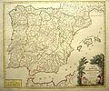
Map of the Iberian peninsula dated 1770. The Kingdoms of Jaén, Córdoba and Seville are collectively referred to under the name Andalucía, while the Kingdom of Granada appears under its individual name.
-
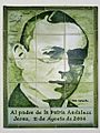
Portrait of Blas Infante, executed in azulejos, located on the avenue in Jerez de la Frontera named in his honour.
-
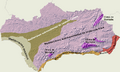
Locations of the principal Andalusian climate types.
-
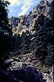
Andalusian firs, Sierra de las Nieves
-
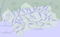
Rivers and basins of Andalusia.
-
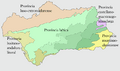
Floristic provinces of Andalusia
-
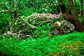
Oaks, rhododendrons and ferns in the Los Alcornocales Natural Park.
-
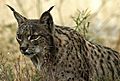
The Iberian lynx (Lynx pardinus)
-
National parks and natural parks in Andalusia.
-
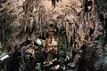
In the Caves of Nerja there are paintings of seals, possibly made by Neanderthals, that are dated to 42,000 years ago; they are the oldest known works of art by humans.
-
Italica, Santiponce
-
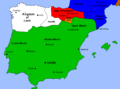
The Caliphate of Córdoba in the early 10th century
-
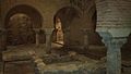
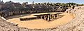
Largest Moorish baths in Spain, in Jaén. The Emirate of Granada was the last to survive, lasting from 1228 until 1492.
-
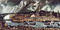
View of Seville and its port in the 16th century, by Alonso Sánchez Coello.
-
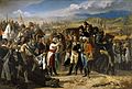
The Surrender of Bailén, by José Casado del Alisal, shows the moment of the interview between General Castaños and General Dupont to agree on the conditions of the surrender of the French army after the Battle of Bailén.
-
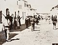
Province of Seville, Spanish Civil War
-
Municipalities of Andalusia
-
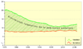
Evolution of the birth and death rates of Andalusia 1975–2007
-
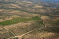
Olive orchards in province of Córdoba.
-
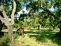
Dehesa Boyal (meadow for grazing animals), Bollullos Par del Condado, Huelva.
-
The town of Adra is surrounded by greenhouses.
-
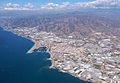
Fishing port of Algeciras.
-
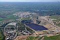
Aznalcóllar mine.
-
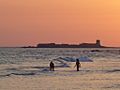
Castle of Sancti Petri, located in San Fernando, Cádiz. One of the largest components of the service sector is "sun and sand" tourism.
-
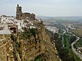
Arcos de la Frontera, province of Cádiz
-
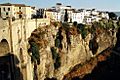
View of Ronda
-
Puerto Banús, Marbella, Costa del Sol.
-
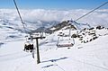
Sierra Nevada Ski Station
-
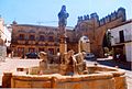
Fuente de los Leones in Baeza, province of Jaén.
-
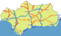
First order roads of Andalusia
-
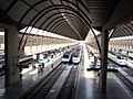
Sevilla-Santa Justa railway station
-
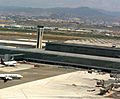
Málaga Airport.
-
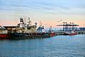
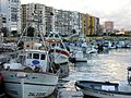
Port of Algeciras.
-
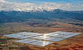
Andasol solar power facility north of Sierra Nevada
-
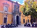
Law School of the University of Granada.
-
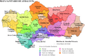
Healthcare districts of Andalusia
-
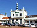
RTVA's headquarters, a former train station in Córdoba.
-
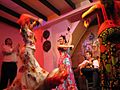
Flamenco dance and music is native to Andalusia.
-
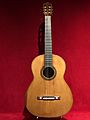
Andalusian Antonio de Torres Jurado in the 19th century invented the current classical guitar.
-
A patio andaluz in Córdoba.
-
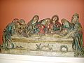
Crying Over the Dead Christ, Pedro Millán, Museum of Fine Arts of Seville.
-
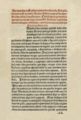
The 1492 Gramática by Antonio de Nebrija
-
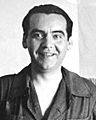
Federico García Lorca prominent poet executed by Francoists during the Spanish Civil War.
-
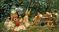
Flamenco, Andalusian dance, 1893, by José Villegas Cordero.
-
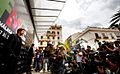
Málaga Film Festival
-
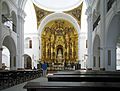
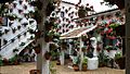
Interior of the Hermitage of El Rocío, with the altar of the Virgin of El Rocío
-
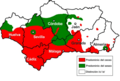
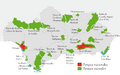
Most Spanish dialects in Spain differentiate between the sound of "z" and "c" (before e and i), pronounced /θ/, and that of "s", pronounced /s/. This distinction is lost in many Andalusian-speaking areas. In some mostly southerly areas, shown here in red, all three letters are pronounced /θ/, which is known as Ceceo. In other areas, all three letters are pronounced (/s/), which is known as Seseo. Still other areas retain the distinction found elsewhere in Spain. Note that the city of Cádiz has seseo.
-
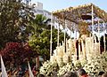
Procession with statue of the Blessed Virgin Mary of the Love of Saint Ferdinand (Maria santísima del amor de San Fernando), Cádiz.
-
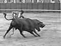
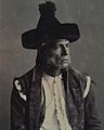
José Gómez Ortega: Joselito "El Gallo".
-
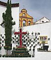
Cruz de mayo of the confraternity Hermandad de la Paz y Esperanza ("Brotherhood of Peace and Hope"), Cuesta del Bailío, Córdoba.
-

Gazpacho served with tropezones (chopped vegetables).
-
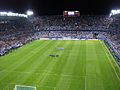
La Rosaleda is the stadium of Málaga CF, one of four Andalusian clubs in Segunda División.
-
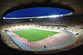
Estadio de La Cartuja was constructed as part of Seville's bid to host the Summer Olympics
-
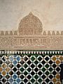
Tiles from the Alhambra.
-
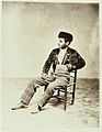
Andalusian, in "Majo" dress
-
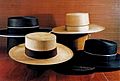
Sombreros cordobeses.
-
Sombrero de catite.
.jpg)


.jpg)


.jpg)


.jpg)

_Gram%C3%A1tica_castellana.png)


.jpg)


See also
 In Spanish: Andalucía para niños
