
Concepción de la Vega facts for kids
Quick facts for kids
La Vega
|
|
|---|---|
|
Municipality
|
|
| Concepción de la Vega | |

La Vega's Cathedral
|
|
| Country | |
| Province | La Vega |
| Municipal Districts | 3 |
| Founded | 1494 |
| Municipality since | 1844 |
| Area | |
| • Total | 410.9 km2 (158.6 sq mi) |
| • Urban | 30.71 km2 (11.86 sq mi) |
| Elevation | 100 m (300 ft) |
| Population
(2014)
|
|
| • Total | 202,864 |
| • Density | 493.71/km2 (1,278.69/sq mi) |
| • Urban | 104,536 |
| Demonym(s) | Vegano (female, vegana) |
| Time zone | UTC-4 (AST) |
| • Summer (DST) | UTC-4 (AST) |
| Distance | 36 km (22 mi) to Santiago 125 km (78 mi) to Santo Domingo |
The Dominican city of Concepción de la Vega, usually known as La Vega, is the head municipality of the La Vega province; it is the largest city in the central part of the country.
The carnival of La Vega, every year during February, is one of the most important carnival in the country.
Contents
Population
The municipality had, in 2014, a total population of 202,864: 102,077 men and 100,787 women. The urban population was 51.5% of the total population.
History

In 1494, Christopher Columbus built a small fort near what is today known of La Vega Vieja (the "Old La Vega"). Columbus gave the name of Concepción to the fort.
A small town grew around the fort and was known as Concepción de la Vega because it was in the western border of the main valley of the island ("Vega" means valley): the Cibao Valley or Royal Valley.
The city was destroyed by a strong earthquake in December of 1562; the town was rebuilt several kilometres to the south of the old one, on the southern side of the Camú river, where the city is now.
Geography
The municipality of Concepción de la Vega has a total area of 410.9 km2 (158.6 sq mi). It has three municipal districts (a municipal district is a subdivision of a municipality). These are Río Verde Arriba, El Ranchito and Tavera.
Concepción de la Vega is at 125 km (78 mi) to the northwest of Santo Domingo and at 36 km (22 mi) to the southeast of Santiago. The municipality is in the western side of the Cordillera Central ("Central mountain chain"), in the "Valle de la Vega Real" ("Royal Valley").
The altitude of the city of Concepción de la Vega is 100 m (328 ft) above sea level.
The municipality of Concepción de la Vega has the Espaillat and Hermanas Mirabal provinces to the north, the Duarte province and the municipality of Jima Abajo to the east, the Monseñor Nouel province to the south and the municipality of Jarabacoa and the province of Santiago province to the west.
The Camú river flows along the northern side of the city; that river, one of the most important river of the country, is a left tributary of the Yuna river.
Climate
La Vega has a tropical wet climate (Köppen-Geiger classification: Af) with no dry or cold season as it is constantly moist (rainfalls during the whole year).
The average amount of rainfall for the year in the city is 1,401.6 mm (55.2 in). The month with the most precipitation on average is May with 178.1 mm (7.0 in) of rainfall, followed by April with 148.1 mm (5.8 in).
The driest season is winter. The month with the least rainfall on average is February with an average of 76.6 mm (3.0 in) followed by June, 84.6 mm (3.3 in), and January, 84.7 mm (3.3 in).
La Vega is in a warm region; the average temperature for the year is 26.3 °C (79 °F). The warmest month, on average, is August with an average temperature of 28.1 °C (82.6 °F). The coolest month on average is January, with an average temperature of 24.1 °C (75.38 °F).
| Climate data for La Vega (1961–1990) | |||||||||||||
|---|---|---|---|---|---|---|---|---|---|---|---|---|---|
| Month | Jan | Feb | Mar | Apr | May | Jun | Jul | Aug | Sep | Oct | Nov | Dec | Year |
| Average high °C (°F) | 29.7 (85.5) |
30.1 (86.2) |
31.2 (88.2) |
31.9 (89.4) |
32.5 (90.5) |
33.4 (92.1) |
33.5 (92.3) |
33.9 (93.0) |
33.9 (93.0) |
33 (91) |
31.1 (88.0) |
29.5 (85.1) |
32.0 (89.5) |
| Daily mean °C (°F) | 24.1 (75.4) |
24.4 (75.9) |
25.2 (77.4) |
26.1 (79.0) |
26.8 (80.2) |
27.6 (81.7) |
27.8 (82.0) |
28.1 (82.6) |
27.9 (82.2) |
27.2 (81.0) |
25.8 (78.4) |
24.3 (75.7) |
26.3 (79.3) |
| Average low °C (°F) | 18.4 (65.1) |
18.6 (65.5) |
19.2 (66.6) |
20.2 (68.4) |
21.1 (70.0) |
21.8 (71.2) |
22 (72) |
22.2 (72.0) |
21.9 (71.4) |
21.4 (70.5) |
20.5 (68.9) |
19 (66) |
20.5 (69.0) |
| Average rainfall mm (inches) | 84.7 (3.33) |
76.6 (3.02) |
87 (3.4) |
148.1 (5.83) |
178.1 (7.01) |
84.6 (3.33) |
102.1 (4.02) |
119 (4.7) |
117.1 (4.61) |
145.1 (5.71) |
139.1 (5.48) |
120.1 (4.73) |
1,401.6 (55.17) |
| Source 1: NOAA | |||||||||||||
| Source 2: Climatemps.com | |||||||||||||
Administrative division
The municipality of La Vega has three municipal districts:
| Code | Municipal district | Population (2010) |
|---|---|---|
| 130102 | Río Verde Arriba | 23,109 |
| 130103 | El Ranchito | 9,626 |
| 130104 | Tavera | 12,490 |
Economy
The most important economic activity in the province is farming; some important crops are plantain, rice, cacao; some vegetables are grown in the valley of the Camú river. Cattle raising is also important, mainly for milk.
There is also here an important Free Trade Zone, a place where there are different companies that made different products to send to other countries and do not pay taxes in the Dominican Republic.
Images for kids
-
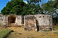
Ruins of La Concepción fortress at Pueblo Viejo National Park.
-
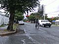
Centro Ciudad sector
-
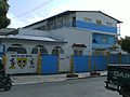
Eugenio María de Hostos School
-

a match being held between La Matica and Enrriquillo
-
Concepción de La Vega section
-
Hermanas Mirabal section
-
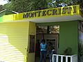
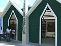
Monte Cristi section
-
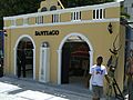
Santiago section
-
Puerto Plata section
-
Mao section
-
San Francisco de Macorís section
-
Nagua section
-
Dajabón section
-
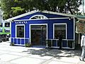
Samaná section
-
Santiago Rodriguez section
-
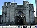
The Catedral of La Vega
-
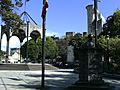
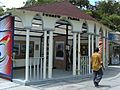
Plaza Duarte
-
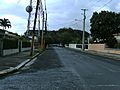
A typical neighborhood
-

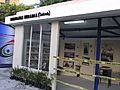
Commercial center in La Vega
-
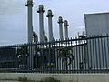
Electrical center in La Vega


See also
 In Spanish: La Vega (República Dominicana) para niños
