Hanover Township, New Jersey facts for kids
Quick facts for kids
Hanover Township, New Jersey
|
|
|---|---|
|
Township
|
|
| Township of Hanover | |

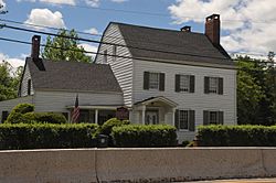
Tuttle House
|
|

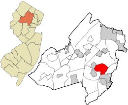
Location in Morris County and the state of New Jersey.
|
|

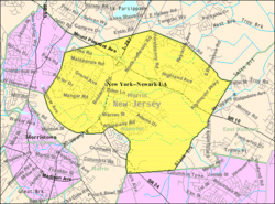
Census Bureau map of Hanover Township, New Jersey
|
|
| Country | |
| State | |
| County | |
| Settled | 1676 |
| Formed | December 7, 1720 |
| Incorporated | March 25, 1740 |
| Named for | House of Hanover |
| Government | |
| • Type | Township |
| • Body | Township Committee |
| Area | |
| • Total | 10.75 sq mi (27.83 km2) |
| • Land | 10.52 sq mi (27.23 km2) |
| • Water | 0.23 sq mi (0.59 km2) 2.14% |
| Area rank | 204th of 565 in state 16th of 39 in county |
| Elevation | 279 ft (85 m) |
| Population | |
| • Total | 13,712 |
| • Estimate
(2019)
|
14,252 |
| • Rank | 179th of 566 in state 15th of 39 in county |
| • Density | 1,302.8/sq mi (503.0/km2) |
| • Density rank | 353rd of 566 in state 22nd of 39 in county |
| Time zone | UTC−05:00 (Eastern (EST)) |
| • Summer (DST) | UTC−04:00 (Eastern (EDT)) |
| ZIP Codes | |
| Area code(s) | 862/973 |
| FIPS code | 3402729550 |
| GNIS feature ID | 0882187 |
| Website | |
Hanover Township is a township in Morris County, New Jersey, United States. At the 2010 United States Census, the township's population was 13,712, reflecting an increase of 814 (+6.3%) from the 12,898 counted in the 2000 Census, which had in turn increased by 1,360 (+11.8%) from the 11,538 counted in the 1990 Census. The township comprises the unincorporated communities of Whippany and Cedar Knolls.
Located just north of the historic town of Morristown (separated by a thin strip of Morris Township) and adjacent to the regional Morristown Municipal Airport, Hanover Township offers many public attractions including the Whippany Railway Museum, the Frelinghuysen Arboretum and the Morris County Library. Patriots' Path, a wilderness walkway and bike trail that stretches for 26 miles (42 km), also passes through the township along the Whippany River.
Contents
History
Hanover Township is the site of the first settlement in northwest New Jersey. New Englanders established a settlement along the Whippany River in 1685 near the current location of the old Whippany Cemetery on Route 10.
Once the Province of West Jersey purchased the land from the local Lenape Native Americans, the original County of Morris was created and comprised all of what is now Morris, Sussex and Warren Counties. The counties were partitioned into townships. Morris' original township was 'Whippenny' which itself comprised all of what is now Morris County.
The name "Hanover" was taken from the House of Hanover in Germany. This namesake was given to the Township of Hanover on December 7, 1720, as a sign of respect to George I of Great Britain who was of the House of Hanover and who ruled over the American colonies in the eighteenth century. Its size has been considerably decreased as the population of the area has increased since the creation of Hanover Township in 1720 and its incorporation on March 25, 1740, with the formation of Morris County. Originally encompassing all of Morris County and parts of Sussex and Warren County, Hanover Township became too unwieldy for a single local government to maintain. The Township was subdivided into smaller municipalities that could provide more responsive local control despite placing greater demands on the local tax base to support new facilities for each.
Portions of the township were taken to form Mendham Township on March 29, 1749. Hanover Township was established by the Township Act of 1798 of the New Jersey Legislature on February 21, 1798. Additional portions of the township were taken to form Chatham Township (February 12, 1806), Rockaway Township (April 8, 1844), Boonton Town (March 16, 1866), Mountain Lakes (April 29, 1924), Morris Plains (April 15, 1926), East Hanover Township and Parsippany-Troy Hills Township (which both split off on May 9, 1928).
During the Revolutionary War, George Washington and his troops often camped in, and marched through, Hanover Township.
The name Whippany is adapted from the Native American word Whippanong which means "where the willow trees grow".
The old settlements of Monroe and Malapardis were consumed by development and what remains are two communities - Whippany and Cedar Knolls - which are roughly separated by Interstate 287.
The Malapardis area of Cedar Knolls is primarily located around Malapardis Road. A section of Malapardis, even though it is in Hanover Township's borders, has a Morris Plains mailing zip code. Another section of Cedar Knolls is called Trailwood which has a section of its land in a Morris Plains ZIP code, the area closest to American Way.
The Monroe area of Whippany is located around Whippany Road and Cedar Knolls Road, marked by a building in the intersection named Monroe Hall.
Until the post-World War II suburbanization of New Jersey, Hanover Township was a sparsely populated industrial town known for its iron works and paper mills. This industry was driven by the ever-present power of the Whippany River. Over the second half of the twentieth century, the Township became thoroughly suburban.
Lucent Technologies had a large facility in Whippany. The first demonstration of long distance television transmission in the United States took place in 1927, with a transmission that went via wire from Washington, D.C., to New York, and from Whippany to New York using radio.
Geography
According to the United States Census Bureau, the township had a total area of 10.727 square miles (27.782 km2), including 10.525 square miles (27.259 km2) of land and 0.202 square miles (0.523 km2) of water (1.88%).
Unincorporated communities, localities and place names located partially or completely within the township include Balls Mills, Black Meadows, Cedar Knolls, Eden Mill, Horse Hill, Jefferson, Lee Meadows, Malapardis, Monroe and Whippany.
Demographics
| Historical population | |||
|---|---|---|---|
| Census | Pop. | %± | |
| 1810 | 3,843 | — | |
| 1820 | 3,503 | −8.8% | |
| 1830 | 3,718 | 6.1% | |
| 1840 | 3,909 | 5.1% | |
| 1850 | 3,614 | −7.5% | |
| 1860 | 3,476 | −3.8% | |
| 1870 | 3,623 | 4.2% | |
| 1880 | 4,138 | 14.2% | |
| 1890 | 4,481 | 8.3% | |
| 1900 | 5,366 | 19.8% | |
| 1910 | 6,228 | 16.1% | |
| 1920 | 8,531 | 37.0% | |
| 1930 | 2,516 | −70.5% | |
| 1940 | 2,812 | 11.8% | |
| 1950 | 3,756 | 33.6% | |
| 1960 | 9,329 | 148.4% | |
| 1970 | 10,700 | 14.7% | |
| 1980 | 11,846 | 10.7% | |
| 1990 | 11,538 | −2.6% | |
| 2000 | 12,898 | 11.8% | |
| 2010 | 13,712 | 6.3% | |
| 2019 (est.) | 14,252 | 3.9% | |
| Population sources: 1810-1920 1840 1850-1870 1850 1870 1880-1890 1890-1910 1910-1930 1930-1990 2000 2010 * = Lost territory in previous decade. |
|||
Census 2010
As of the census of 2010, there were 13,712 people, 5,308 households, and 3,790 families residing in the township. The population density was 1,302.8 per square mile (503.0/km2). There were 5,526 housing units at an average density of 525.0 per square mile (202.7/km2)*. The racial makeup of the township was 85.53% (11,728) White, 1.01% (138) Black or African American, 0.04% (6) Native American, 10.80% (1,481) Asian, 0.01% (1) Pacific Islander, 1.26% (173) from other races, and 1.35% (185) from two or more races. [[Hispanic (U.S. Census)|Hispanic or Latino of any race were 4.59% (630) of the population.
There were 5,308 households out of which 30.9% had children under the age of 18 living with them, 61.1% were married couples living together, 8.0% had a female householder with no husband present, and 28.6% were non-families. 25.1% of all households were made up of individuals, and 12.9% had someone living alone who was 65 years of age or older. The average household size was 2.58 and the average family size was 3.12.
In the township, the population was spread out with 22.2% under the age of 18, 5.5% from 18 to 24, 24.2% from 25 to 44, 30.0% from 45 to 64, and 18.1% who were 65 years of age or older. The median age was 43.9 years. For every 100 females there were 91.8 males. For every 100 females ages 18 and old there were 88.1 males.
The Census Bureau's 2006-2010 American Community Survey showed that (in 2010 inflation-adjusted dollars) median household income was $100,962 (with a margin of error of +/- $6,654) and the median family income was $115,341 (+/- $10,572). Males had a median income of $76,766 (+/- $2,263) versus $61,441 (+/- $5,321) for females. The per capita income for the borough was $44,123 (+/- $2,675). About 1.5% of families and 2.2% of the population were below the poverty line, including 1.5% of those under age 18 and 1.9% of those age 65 or over.
Census 2000
At the 2000 United States Census there were 12,898 people, 4,745 households and 3,620 families residing in the township. The population density was 1,209.6 per square mile (467.2/km2). There were 4,818 housing units at an average density of 451.8 per square mile (174.5/km2). The racial makeup of the township was 88.79% White, 1.09% African American, 0.05% Native American, 8.71% Asian, 0.01% Pacific Islander, 0.59% from other races, and 0.77% from two or more races. Hispanic or Latino of any race were 3.50% of the population.
There were 4,745 households, of which 32.8% had children under the age of 18 living with them, 65.8% were married couples living together, 8.0% had a female householder with no husband present, and 23.7% were non-families. 19.6% of all households were made up of individuals, and 7.7% had someone living alone who was 65 years of age or older. The average household size was 2.71 and the average family size was 3.13.
Age distribution was 22.8% under the age of 18, 5.6% from 18 to 24, 30.1% from 25 to 44, 26.6% from 45 to 64, and 14.9% who were 65 years of age or older. The median age was 40 years. For every 100 females, there were 94.7 males. For every 100 females age 18 and over, there were 91.1 males.
The median household income was $84,115, and the median family income was $93,937. Males had a median income of $59,278 versus $40,799 for females. The per capita income for the township was $37,661. About 0.7% of families and 1.2% of the population were below the poverty line, including 1.0% of those under age 18 and 1.4% of those age 65 or over.
Arts and culture
The township is home to the Whippany-based Hanover Wind Symphony, which was established in 1985.
Parks and recreation
Municipal parks and recreational facilities include:
- Bee Meadow Park and Pool
- Blackbrook Park
- Central Park
- Malapardis Park
- Township Community Center
Transportation
Roads and highways
As of May 2010[update], the township had a total of 77.54 miles (124.79 km) of roadways, of which 62.47 miles (100.54 km) were maintained by the municipality, 7.46 miles (12.01 km) by Morris County and 7.61 miles (12.25 km) by the New Jersey Department of Transportation.
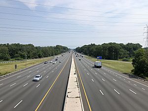
Interstate 287, Route 10 and Route 24 pass through the Township. Interstate 80, U.S. Route 46 and U.S. Route 202 are nearby.
Public transportation
NJ Transit offers local bus service on the 871, 872 and 874 routes, with service between the township and Newark on the 73 route. Until 2010, service in the borough was offered on the MCM8 route, until subsidies offered to the local provider were eliminated by NJ Transit as part of budget cuts.
The Whippany Line of the Morristown and Erie Railway, a small freight line, traverses the township. Established in 1895, the line runs from Morristown and runs through East Hanover Township and Hanover Township to Roseland.
Name confusion
There is some confusion over the place names in Hanover Township and this is understandable given the sometimes arcane usage of place names in New Jersey.
Whippany and Cedar Knolls are place names for unincorporated communities. They each have their own ZIP code, post office and fire department but are otherwise simply neighborhood names.
Next to Hanover Township is East Hanover Township which has a neighborhood called 'Hanover'. Also, there is a New Hanover Township and a North Hanover Township in Burlington County, and several other Hanover Townships in Pennsylvania and Michigan. Furthermore, street signs and maps often do not identify Hanover Township but instead indicate one of the place names.
Residents of Whippany and Cedar Knolls have become accustomed to indicating that they live in either Whippany or Cedar Knolls and not in Hanover Township. Some confusion comes from the difference between neighborhood boundaries, and the arbitrary ZIP Code boundaries that do not necessarily coincide with municipal boundaries resulting in township mailing addresses which use place names outside of the township. Whippany's ZIP code is 07981 and Cedar Knolls' is 07927.
Notable people
People who were born in, residents of, or otherwise closely associated with Hanover Township include:
- Arthur R. Albohn (1921–2008), member of the New Jersey General Assembly from 1980 to 1996.
- George Hammell Cook (1818–1889), State Geologist of New Jersey and namesake of Cook College at Rutgers University.
- Damon Daunno (born 1984), actor who starred in the 2019 Broadway revival of Oklahoma!.
- Rosemarie DeWitt (born 1974), actress.
- Mahlon Dickerson (1770–1853), Governor of New Jersey and U.S. Senator who also served as United States Secretary of the Navy.
- Smith Ely Jr. (1825–1911), member of the United States House of Representatives from New York and Mayor of New York City.
- Harry Fanok (born 1940), former MLB pitcher who played for the St. Louis Cardinals.
- Dan Frischman (born 1959), character actor, noted for his many roles of playing socially inept "geeks" and "nerds".
- Ashbel Green (1762–1848), Chaplain of the United States House of Representatives from 1792 to 1800 and President of Princeton University from 1812 to 1822.
- Aaron Kitchell (1744–1820), politician who represented New Jersey in both the United States House of Representatives and the United States Senate.
- Othniel Looker (1757–1845), Fifth Governor of Ohio.
- Thomas Millidge (c. 1735–1816), loyalist during the American Revolutionary War who later became a wealthy landowner in Canada.
- William W. Phelps (1792–1892), best known for his legacy of LDS hymns, many of which appear in the current edition of the LDS Hymnal.
- Brian Saxton (born 1972), tight end who played in the NFL for the New York Giants.
- Enoch Cobb Wines (1806–1879), minister of the Congregational church and prison reform advocate.
Economy
Major employers in Hanover Township include:
- In Whippany: Bayer, Suburban Propane, Omnicare, Halo Pharma, Drew Marine, Arthur J. Gallagher & Co.
- In Cedar Knolls: Edgewell Personal Care and ShopRite
Sports
Home of the 2017 Junior Pee Wee Division Youth Football National Champions sponsored by the NFL Hall of Fame.
Education
Public schools
For pre-kindergarten through eighth grade, public school students attend the Hanover Township Public Schools. As of the 2018–19 school year, the district, comprised of four schools, had an enrollment of 1,382 students and 129.5 classroom teachers (on an FTE basis), for a student–teacher ratio of 10.7:1. Schools in the district (with 2018–19 enrollment data from the National Center for Education Statistics) are Bee Meadow School with 334 students in grades K-5, Mountview Road School with 317 students in grades K-5, Salem Drive School with 242 students in grades K-5 and Memorial Junior School with 478 students in grades 6–8.
During the 1998–99 school year, Bee Meadow School was awarded the National Blue Ribbon School Award of Excellence by the United States Department of Education, the highest award an American school can receive.
Students in public school for ninth through twelfth grades attend Whippany Park High School in the Whippany section of Hanover Township, as part of the Hanover Park Regional High School District, which also serves students from the neighboring communities of East Hanover Township and Florham Park, who attend Hanover Park High School in East Hanover. As of the 2018–19 school year, the high school had an enrollment of 642 students and 58.4 classroom teachers (on an FTE basis), for a student–teacher ratio of 11.0:1. The seats on the high school district's nine-member board of education are allocated to the constituent municipalities based on population, with Hanover Township assigned three seats.
Parochial and private
There are also three private special education schools - The Allegro School, The Calais School and P.G. Chambers School.
See also
 In Spanish: Municipio de Hanover (Nueva Jersey) para niños


