
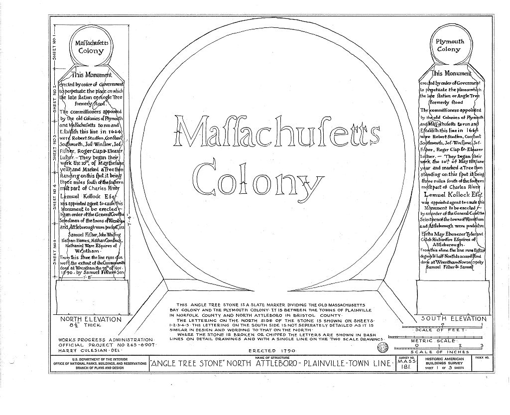
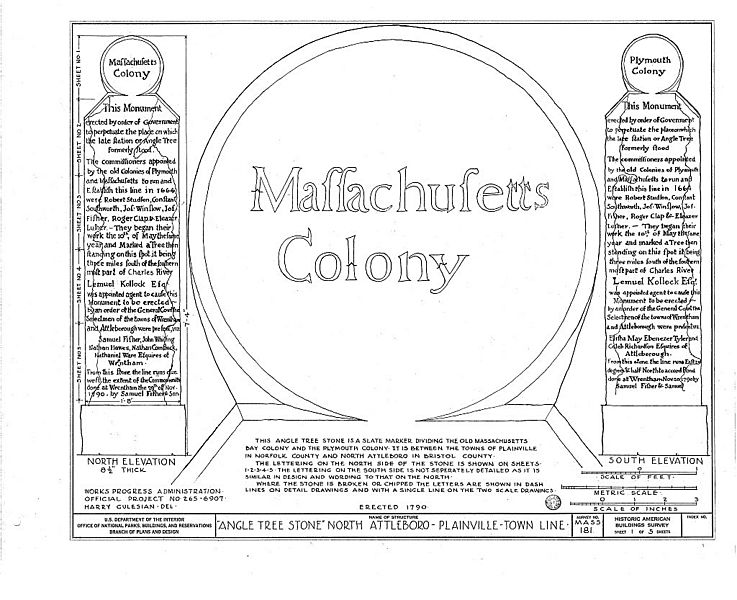
Image: "Angle Tree Stone" North Attleboro - Plainville - Town Line HABS Drawing Sheet 1
Size of this preview: 737 × 600 pixels. Other resolutions: 295 × 240 pixels | 1,024 × 833 pixels.
Original image (1,024 × 833 pixels, file size: 171 KB, MIME type: image/jpeg)
Description: Architectural Drawing of the Angle Tree Stone 1935 North Attleboro - Plainville - Town Line Historic American Building Survey (HABS) Drawing Sheet 1 of 6 "THIS ANGLE TREE STONE IS A SLATE MARKER DIVIDING THE OLD MASSACHUSETTS BAY COLONY AND THE PLYMOUTH COLONY. IT IS BETWEEN THE TOWNS OF PLAINEVILLE IN NORFOLK COUNTY AND NORTH ATTLEBORO IN BRISTOL COUNTY."
Title: "Angle Tree Stone" North Attleboro - Plainville - Town Line HABS Drawing Sheet 1
Credit: https://www.loc.gov/resource/hhh.ma0520.sheet/?sp=2
Author: Historic American Building Survey (HABS)
Usage Terms: Public domain
License: Public domain
Attribution Required?: No
Image usage
The following page links to this image:

All content from Kiddle encyclopedia articles (including the article images and facts) can be freely used under Attribution-ShareAlike license, unless stated otherwise.