
Image: (A chart of Boston Bay) (2674893303)
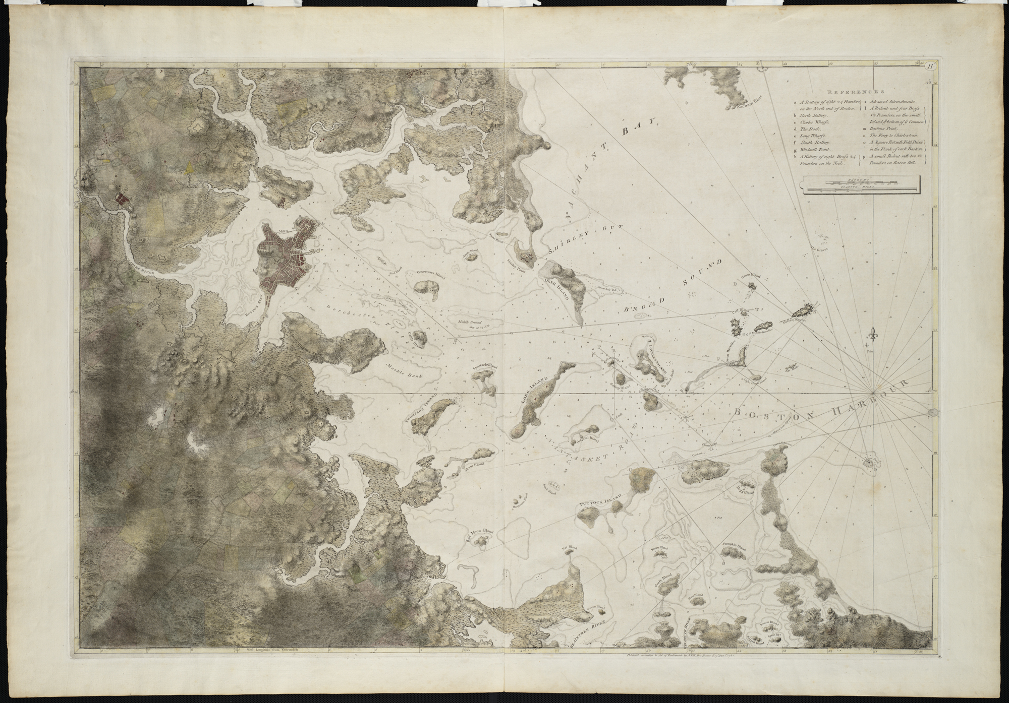
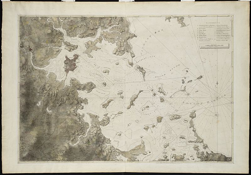
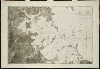
Description: Zoom into this map at maps.bpl.org. Author: Des Barres, Joseph F. W. Publisher: J.F.W. Des Barres Date: 1781. Location: Boston Bay (Mass.) Scale: Scale not given. Call Number: G3762.B6P5 1781.D4 This survey of Boston Harbor, first published in 1775 in Des Barress Atlantic Neptune, was the pre-eminent chart of the harbor produced in the 18th century. It was used by the Royal Navy during the American Revolution, and long after that conflict by American and English merchants. The chart was based on surveys by George Callendar, master of His Majestys Ship Romney, stationed in Boston Harbor in 1769. Displayed here is the fourth state of the chart which depicts the inland topography in great detail. Roads, taverns, streams and farmhouses are shown throughout the countryside.
Title: A chart of Boston Bay (2674893303)
Credit: [A chart of Boston Bay]
Author: http://maps.bpl.org
Usage Terms: Creative Commons Attribution 2.0
License: CC BY 2.0
License Link: https://creativecommons.org/licenses/by/2.0
Attribution Required?: Yes
Image usage
The following image is a duplicate of this image (more details):
.jpg)
The following page links to this image:

_(2674893303).jpg)