
Image: 0000001c
Size of this preview: 465 × 600 pixels. Other resolutions: 186 × 240 pixels | 954 × 1,230 pixels.
Original image (954 × 1,230 pixels, file size: 606 KB, MIME type: image/jpeg)
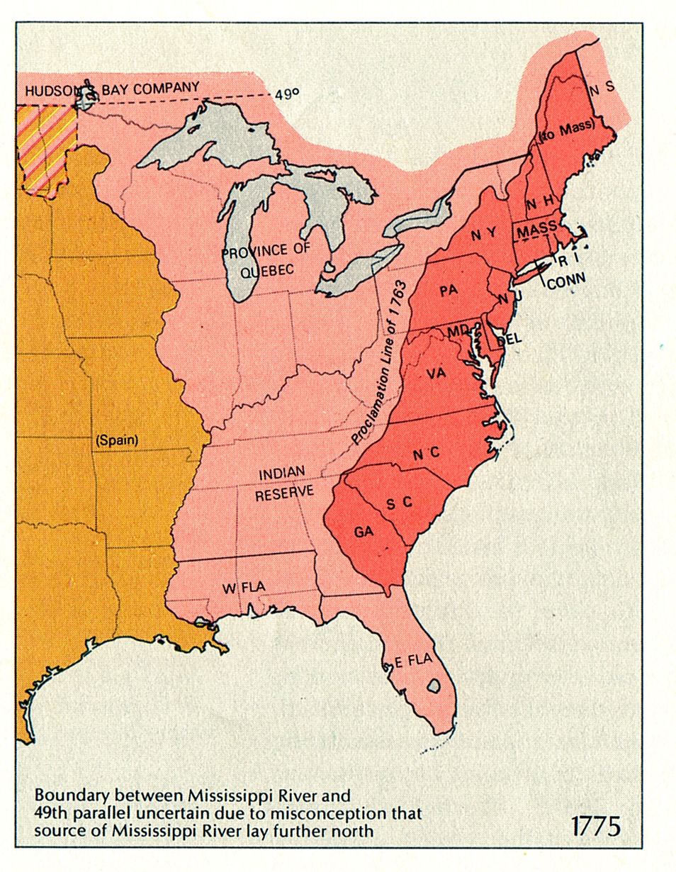
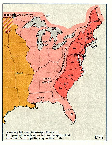
Description: Map of territorial growth in 1775
Title: 0000001c
Credit: Dr. William J. Ball, http://teachpol.tcnj.edu/amer_pol_hist/thumbnail28.html
Author: U.S. Department of the Interior
Permission: Public Domain
Usage Terms: Public domain
License: Public domain
Attribution Required?: No
Image usage
There are no pages that link to this image.

All content from Kiddle encyclopedia articles (including the article images and facts) can be freely used under Attribution-ShareAlike license, unless stated otherwise.