
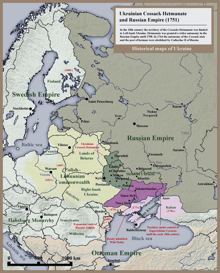
Image: 007 Ukrainian Cossack Hetmanate and Russian Empire 1751
Size of this preview: 483 × 599 pixels. Other resolutions: 193 × 240 pixels | 767 × 952 pixels.
Original image (767 × 952 pixels, file size: 382 KB, MIME type: image/jpeg)
Description: Historical map of Ukrainian Cossack Hetmanate and territory of Zaporozhian Cossacks under rule of Russian Empire (1751).
Title: 007 Ukrainian Cossack Hetmanate and Russian Empire 1751
Credit: Own work - Other example of similar map: http://litopys.org.ua/coss5/koh16.htm, http://www.jewishgen.org/ukraine/GEO_Maps.asp
Author: SeikoEn
Usage Terms: Creative Commons Attribution-Share Alike 3.0
License: CC-BY-SA-3.0
License Link: http://creativecommons.org/licenses/by-sa/3.0/
Attribution Required?: Yes
Image usage
The following page links to this image:

All content from Kiddle encyclopedia articles (including the article images and facts) can be freely used under Attribution-ShareAlike license, unless stated otherwise.