
Image: 16th century Portuguese Spanish trade routes
Size of this preview: 800 × 335 pixels. Other resolutions: 320 × 134 pixels | 2,835 × 1,188 pixels.
Original image (2,835 × 1,188 pixels, file size: 745 KB, MIME type: image/png)
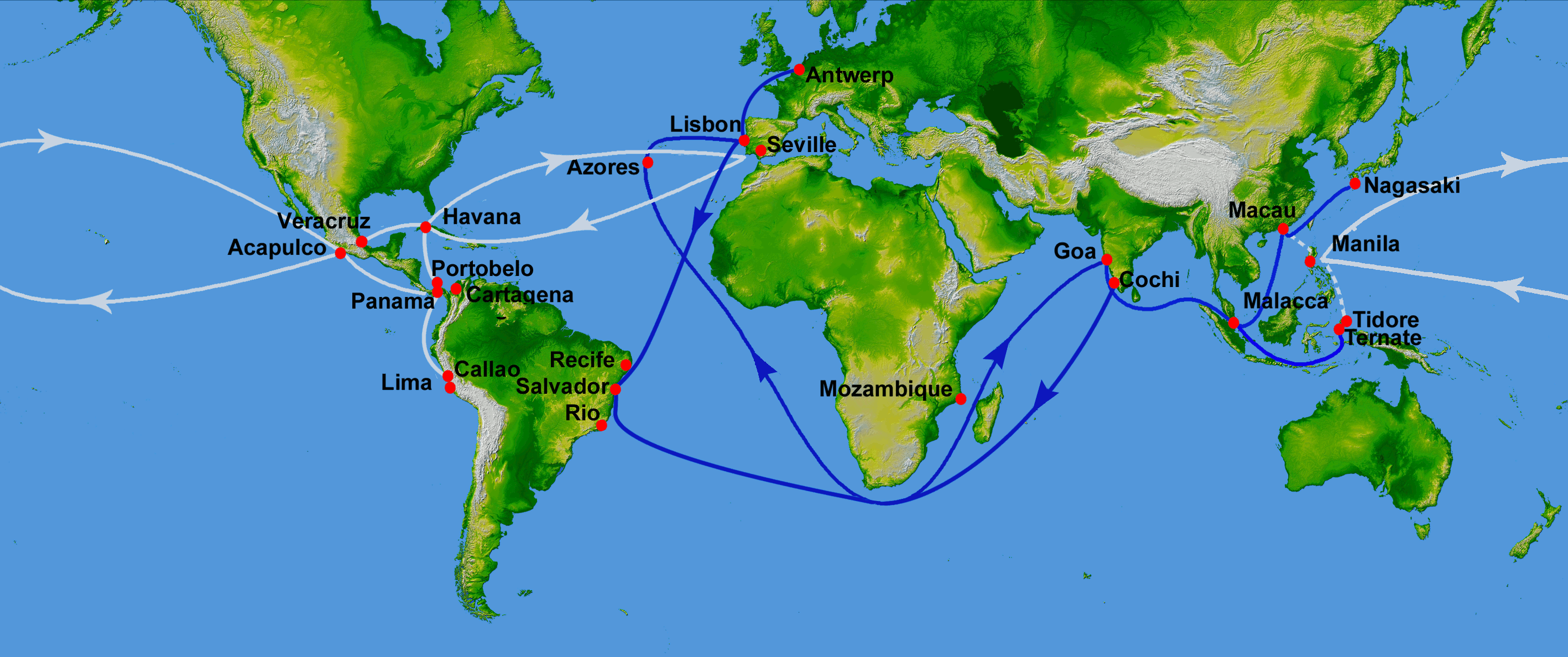
Description: Map showing main Portuguese (blue) and Spanish (white) oceanic trade routes in the 16th century, as a result of the exploration during the Age of Discovery. Showing the Spanish colonial Manila-Acapulco Galleons route (1565-1815) between the Viceroyalty of New Spain (México) and the Spanish East Indies (Philippines), using the ports of Acapulco and Cavite. PIA03395: World in Mercator Projection, Shaded Relief and Colored Height
Title: 16th century Portuguese Spanish trade routes
Credit: World_Topography.jpg
Author: World_Topography.jpg: NASA/JPL/NIMA derivative work: Uxbona (talk)
Usage Terms: Public domain
License: Public domain
Attribution Required?: No
Image usage
The following 16 pages link to this image:
- Age of Discovery
- Asiento de Negros
- Colonialism
- Conquistador
- Filipinos
- Iberian ship development, 1400–1600
- List of World Heritage Sites in Mexico
- Manila galleon
- Marine navigation
- Piracy in the Caribbean
- Privateer
- Spanish treasure fleet
- Spice trade
- Trade route
- Treaty of Tordesillas
- Viceroyalty of New Spain

All content from Kiddle encyclopedia articles (including the article images and facts) can be freely used under Attribution-ShareAlike license, unless stated otherwise.