
Image: 1768 James Craig Map of New Town, Edinburgh, Scotland (First Plan of New Town) - Geographicus - Edinburgh-craig-1768
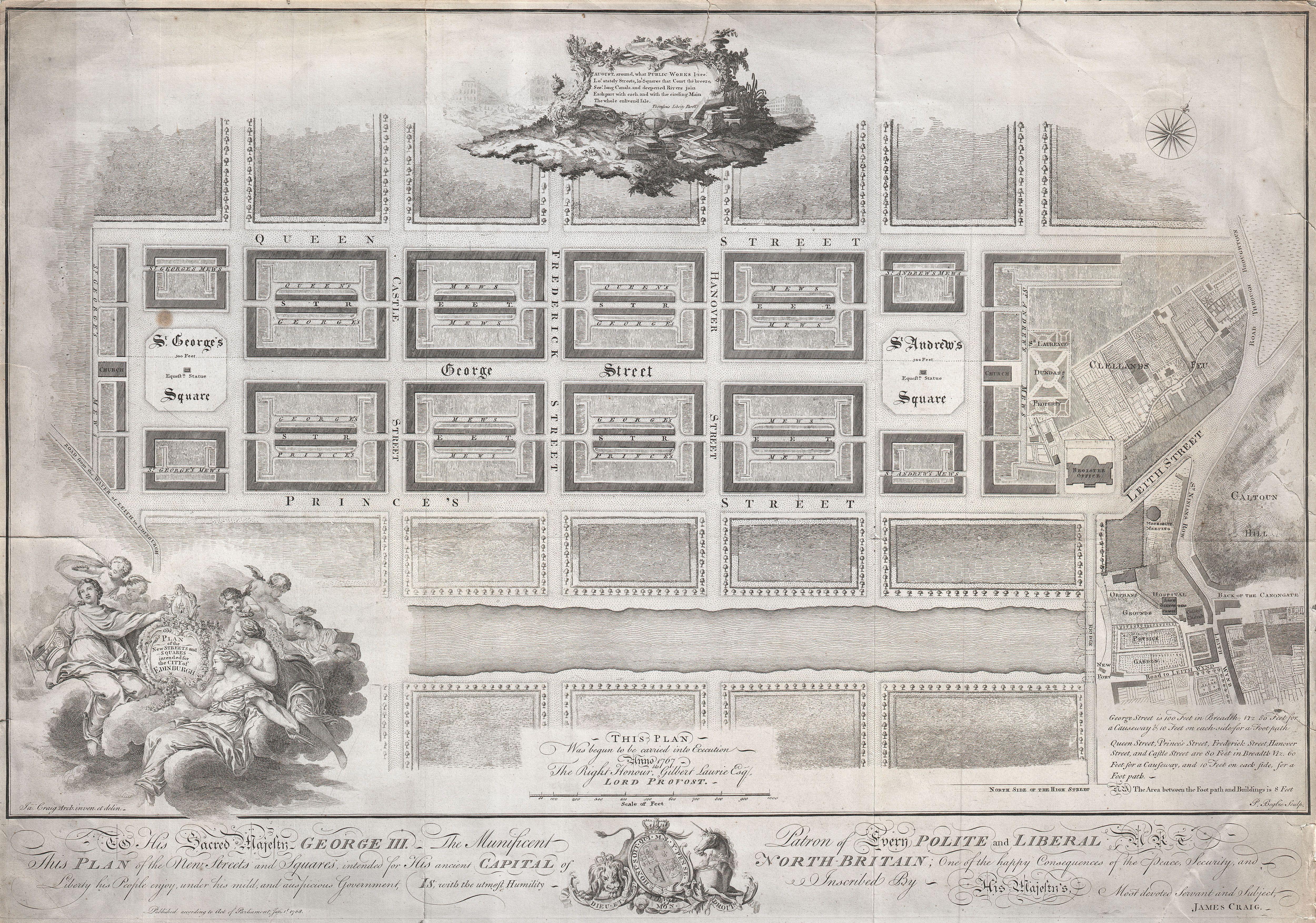
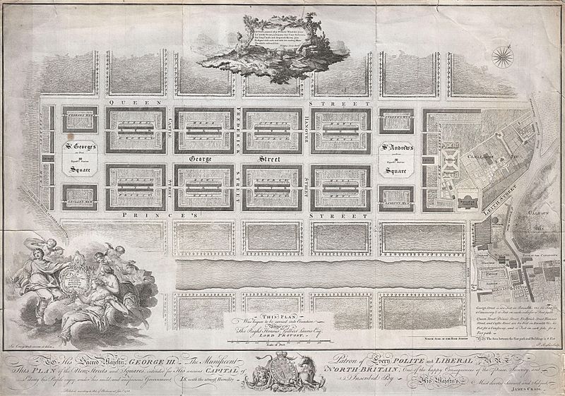
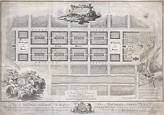
Description: Drafted for the city planning committee in 1768 by James Craig, this is the definitive plan of Edinburgh, Scotland’s New Town. Oriented to the North, this plan details the streets of Edinburgh north of the Loch Nor (today the Prince’s Street Gardens) between St. George’s Square (modern day Charlotte Square) and St. Andrews Square. A dedication to King George the III illustrates the lower part of the map. An elaborate title cartouche decorates the lower left hand quadrant. Thompson’s poem appears in a secondary cartouche at the top center. In 1766 the City Fathers of Edinburgh lead by Lord Provost George Drummond instituted a plan to extend the city’s border to encompass the field’s north of the Nor Loch. The plan, intended to modernize the city and ease the crowded conditions of the old Royal Burgh, was turned into a competition. James Craig, an Edinburgh native, having around this time just completed his apprenticeship as a mason, found the he had a fine hand for drafting. Inspired by his uncle James Thomson’s well known poem Liberty , August, around, what Public Works I see, Lo’ stately Streets, lo’ Squares that Court the breeze, See’ long Canals, and deepened Rivers join Eash part with each, and with the circling Main The whole enlivened Isle… Craig submitted this plan. Though conservative in its vision, Craig’s plan won the city’s design contest and he was awarded with the “Freedom of the City” in 1767. Sadly the Lord Provost George Drummond who instituted the contest died before his dream of expanding the city was realized. It was left to his successor, the Lord Provost Gilbert Laurie, who is named on this map, to realize Craig’s plan. Today the streets are laid out much as Craig envisioned them with broad east –west avenues separating housing blocks bisected by smaller mews. Drawn by James Craig and engraved by P. Begbie in 1768. When this plan was printed in 1768, only 500 were issued. With such a small printing run as an independently issued map, we can safely assume that very few examples, other than the one you see here, have survived to this day. Only one recorded example of this map has appeared at auction in the last 30 years. Dated and copyrighted “Published according to Act of Parliament, Jan. 1st, 1768.
Title: Plan of the New Streets and Squares intended for the city of Edinburgh.
Credit: This file was provided to Wikimedia Commons by Geographicus Rare Antique Maps, a specialist dealer in rare maps and other cartography of the 15th, 16th, 17th, 18th and 19th centuries, as part of a cooperation project. Deutsch | English | français | македонски | Nederlands | polski | +/−
Author: http://www.geographicus.com/mm5/cartographers/jcraig.txt
Permission: This is a faithful photographic reproduction of a two-dimensional, public domain work of art. The work of art itself is in the public domain for the following reason: This work is in the public domain in its country of origin and other countries and areas where the copyright term is the author's life plus 100 years or less. You must also include a United States public domain tag to indicate why this work is in the public domain in the United States. This file has been identified as being free of known restrictions under copyright law, including all related and neighboring rights. The official position taken by the Wikimedia Foundation is that "faithful reproductions of two-dimensional public domain works of art are public domain". This photographic reproduction is therefore also considered to be in the public domain in the United States. In other jurisdictions, re-use of this content may be restricted; see Reuse of PD-Art photographs for details.
Usage Terms: Public domain
License: Public domain
Attribution Required?: No
Image usage
The following 3 pages link to this image:

_-_Geographicus_-_Edinburgh-craig-1768.jpg)