
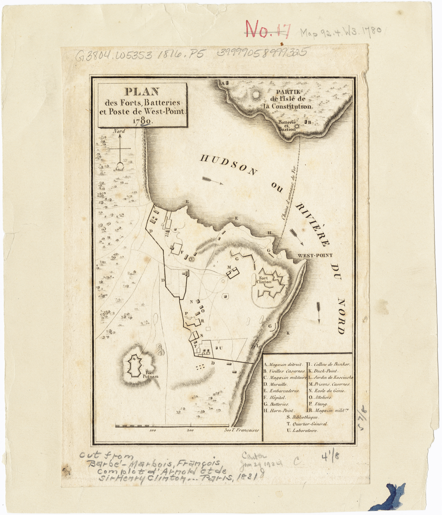
Image: 1780 Map of West Point Defenses
Size of this preview: 515 × 600 pixels. Other resolutions: 206 × 240 pixels | 1,718 × 2,000 pixels.
Original image (1,718 × 2,000 pixels, file size: 2.56 MB, MIME type: image/jpeg)
Description: Plan des forts, batteries et poste de West-Point, 1780. Map of the defense network at West Point, including the Great Chain, Constitution Island, Fort Clinton, and Fort Putnam.
Title: 1780 Map of West Point Defenses
Credit: Norman B. Leventhal Map Center, Boston Public Library Call #G3804.W53S3 1780 .P5
Author: Unknown, published by Pierre Didot
Usage Terms: Public domain
License: Public domain
Attribution Required?: No
Image usage
The following image is a duplicate of this image (more details):
.jpg)
The following page links to this image:

All content from Kiddle encyclopedia articles (including the article images and facts) can be freely used under Attribution-ShareAlike license, unless stated otherwise.