
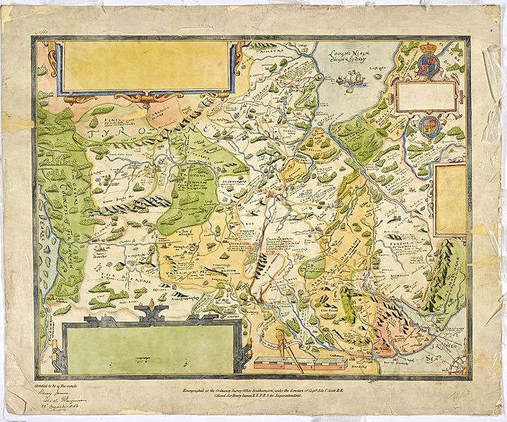
Image: 17th Century Barony Maps c.1609 - Tyrone etc. (27484911573)

Size of this preview: 719 × 599 pixels. Other resolutions: 288 × 240 pixels | 2,048 × 1,707 pixels.
Original image (2,048 × 1,707 pixels, file size: 2.63 MB, MIME type: image/jpeg)
Description: 17th Century Barony Maps c.1609 - Tyrone etc. (From collection of maps of escheated counties of Ireland) PRONI Ref: T1652/2
Title: 17th Century Barony Maps c.1609 - Tyrone etc. (27484911573)
Credit: https://www.flickr.com/photos/proni/27484911573/
Author: Public Record Office of Northern Ireland
Permission: At the time of upload, the image license was automatically confirmed using the Flickr API. For more information see Flickr API detail.
Usage Terms: No known copyright restrictions
License: No restrictions
License Link: https://www.flickr.com/commons/usage/
Attribution Required?: No
Image usage
The following page links to this image:

All content from Kiddle encyclopedia articles (including the article images and facts) can be freely used under Attribution-ShareAlike license, unless stated otherwise.
.jpg)