
Image: 1834-mouth of black river-lorain
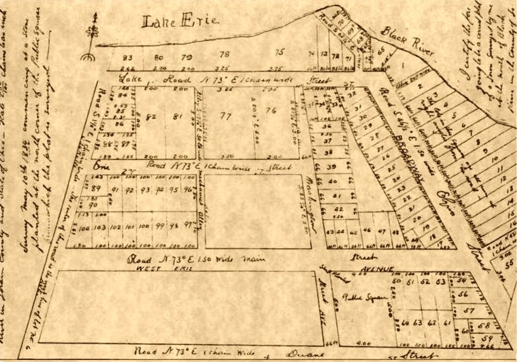
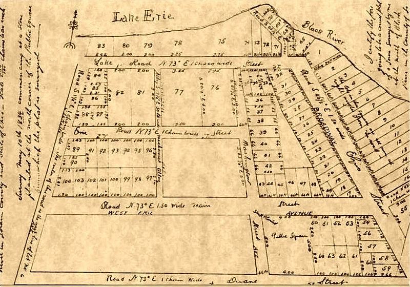
Description: 1834 Plat Map for the village named "Black River". The first known registered survey for what was, 40 years later, to become the City of Lorain, Ohio. This village was originally officially 'platted' about 1822, by pioneer John S. Reid upon the farm that he had purchased at the mouth of the Black River about 1808; and after his death, additional village lots were added within the above 'plat' by his son Conrad Reid and his sons-in-laws Daniel T. Baldwin, Quartus Gillmore, and Barna Meeker. The village was renamed "Charleston" in 1836, although that name was quickly rejected by most its own citizens, and it was publicly known almost continuously, as simply "Black River village", until it was finally named Lorain in 1874. [Note the names of the streets, some of which were added in at a much later date. "Lake Street" should not be confused with Lake Road, which is "Main Street"/"West Erie" on this map.]. {Caption written by wiki-user ohiopioneers, on file originally uploaded 8 Apr 2012 (updated June 2016).
Title: 1834-mouth of black river-lorain
Credit: (map) Lorain County Governmental
Author: Durand (independent surveyor)
Usage Terms: Public domain
License: Public domain
Attribution Required?: No
Image usage
The following page links to this image:
