
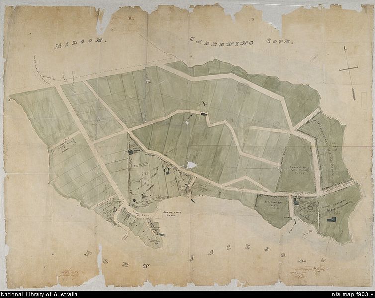
Image: 1840s Map of Kirribilli Point

Size of this preview: 754 × 599 pixels. Other resolutions: 302 × 240 pixels | 760 × 604 pixels.
Original image (760 × 604 pixels, file size: 106 KB, MIME type: image/jpeg)
Description: Earliest detailed map of Kirribilli Point. Robert Campbells Estate, Milsons Point and Kirribilli, Sydney. Scale indeterminable. Map of peninsula at North Sydney showing leases, roads, weather board cottages, jetties, wells, orchards, bee hives, milking bails and stables and the graves of the three typhoid victims and the attending physician from the Surry. inset. Amicus Number: 8560781.
Title: 1840s Map of Kirribilli Point
Credit: National Library of Australia http://nla.gov.au/nla.map-f903-e-cd
Author: Unknown
Usage Terms: Public domain
License: Public domain
Attribution Required?: No
Image usage
The following page links to this image:

All content from Kiddle encyclopedia articles (including the article images and facts) can be freely used under Attribution-ShareAlike license, unless stated otherwise.