
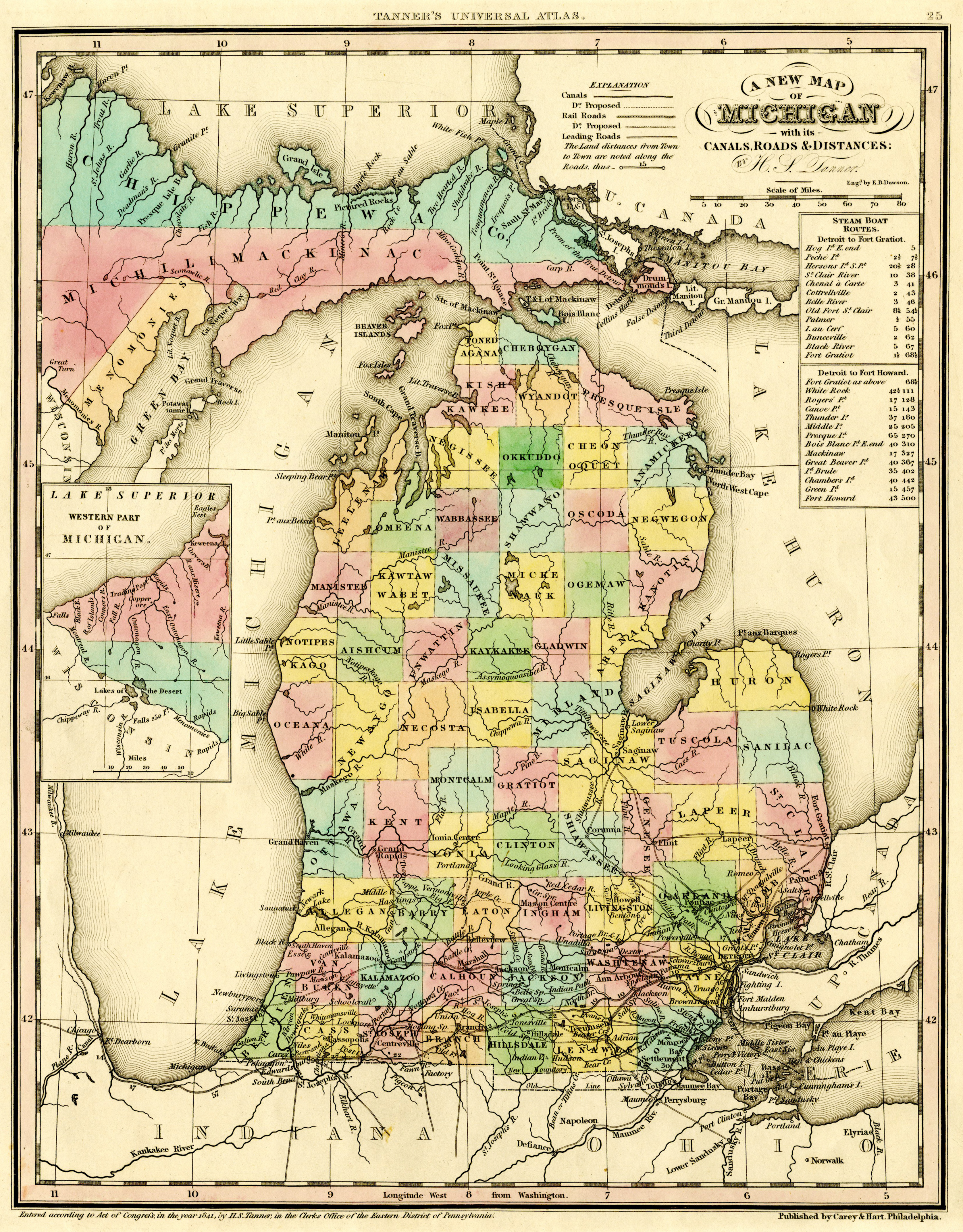
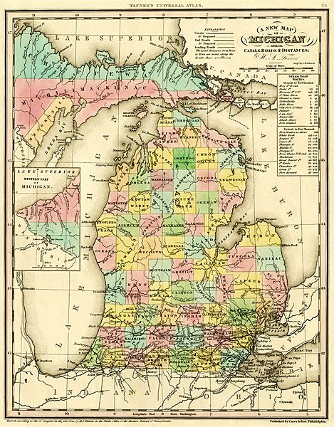
Image: 1842 A new map of Michigan with its canals roads distances by H.S. Tanner
Description: A new map of Michigan with its canals, roads & distances / by H.S. Tanner ; engd. by E.B. Dawson. Philadelphia : Carey & Hart, [1842]. Scan of a map in the collection of the Michigan State University Map Library. Original map was detached from an atlas published in 1842: A new universal atlas. Philadelphia : Carey & Hart, 1842. MSU Libraries catalog record: http://catalog.lib.msu.edu/record=b12049211~S39a The map shows early names (assigned 1840) of northern Michigan counties, many of which were renamed in 1843. Some of these names are misspelled: Correct spelling / Name on map: Kautawaubet / Kawtawwabet Keskkauko / Kishkawkee Leelanau / Leelenaw Mecosta / Necosta Meegisee / Negissee Mikenauk / Mickenauk Notipekago / Notispekago Shawono / Shawwano Wabassee / Wabbassee
Title: 1842 A new map of Michigan with its canals roads distances by H.S. Tanner
Credit: http://www.lib.msu.edu/branches/map/MiJPEGS/843-D-1842-Tanner/
Author: Henry Schenck Tanner
Usage Terms: Public domain
License: Public domain
Attribution Required?: No
Image usage
The following page links to this image:
