
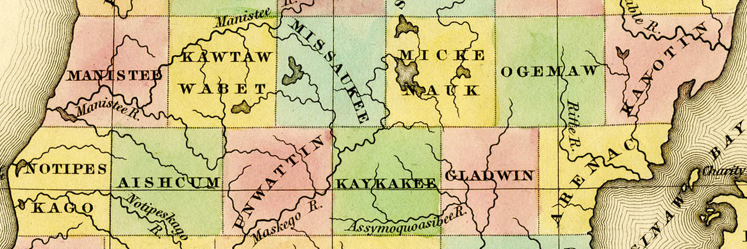
Image: 1842 Manistee Kawtawwabet Missaukee Mickenauk Ogemaw Kanotin Notipeskago Aishcum Unwattin Kaykakee Gladwin Arenac counties Michigan
Description: Detail of A New Map of Michigan With Its Canals, Roads & Distances by H.S. Tanner, 1842, showing: Manistee County Kautawaubet County (misspelled "Kawtawwabet") (later renamed Wexford County) Missaukee County Mikenauk County (misspelled "Mickenauk") (later renamed Roscommon County) Ogemaw County Kanotin County (later renamed Iosco County) Notipekago County (misspelled "Notispekago") (later renamed Mason County) Aishcum County (later renamed Lake County) Unwattin County (later renamed Osceola County) Kaykakee County (later renamed Clare County) Gladwin County Arenac County
Title: 1842 Manistee Kawtawwabet Missaukee Mickenauk Ogemaw Kanotin Notipeskago Aishcum Unwattin Kaykakee Gladwin Arenac counties Michigan
Credit: File:1842 A new map of Michigan with its canals roads distances by H.S. Tanner.jpg
Author: Henry Schenck Tanner
Usage Terms: Public domain
License: Public domain
Attribution Required?: No
Image usage
The following 8 pages link to this image:
