
Image: 1845 Williamsburg Map
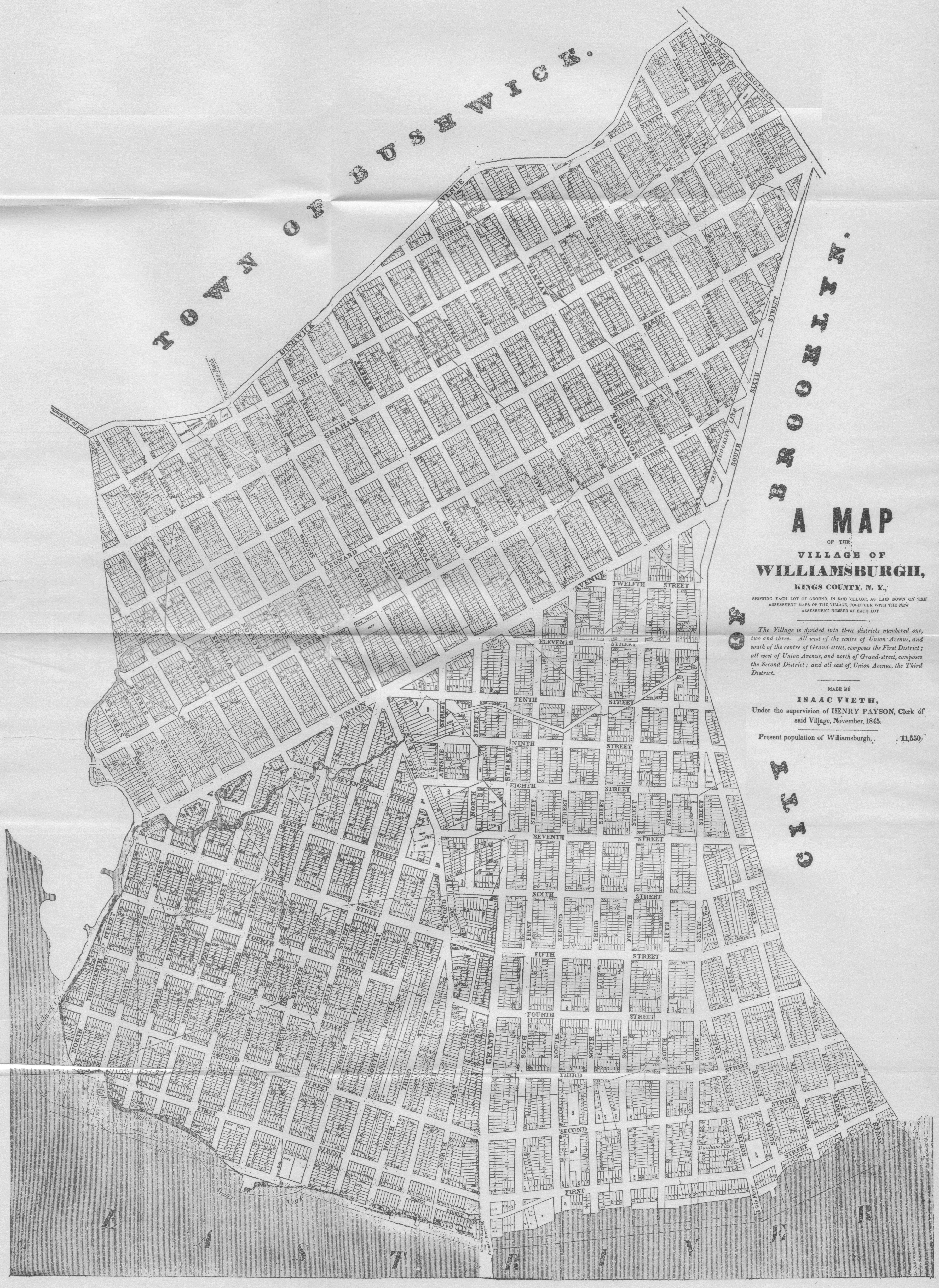
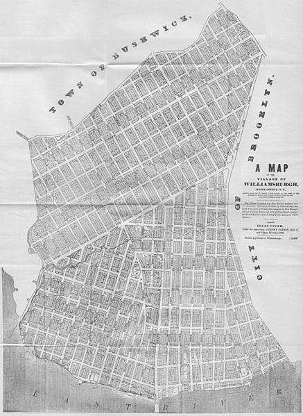
Description: A Map of the Village of Williamsburg, Kings County, NY, showing each lot of ground in said village, as laid on the assessment maps of the village, together with the new assessment number of each lot. The village is divided into three districts numbered on, two and three. All west of the centre of Union Avenue, and south of the centre of Grand-street, composes the First District; all west of Union Avenue, and north of Grand-street, composes the Second District; and all east of Union Avenue, the Third District. Made by Isaac Vieth, under the supervision of Henry Payson, Clerk of said Village, November 1845. Present population of Williamsburgh, 11,550. North is left.
Title: 1845 Williamsburg Map
Credit: scanned from original
Author: Isaac Vieth
Permission: public domain
Usage Terms: Public domain
License: Public domain
Attribution Required?: No
Image usage
The following page links to this image:
