
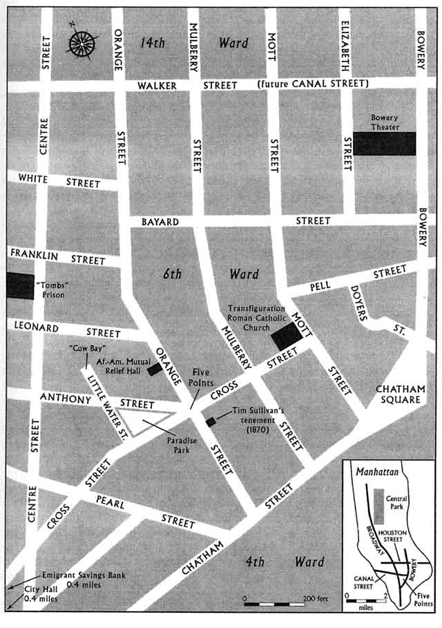
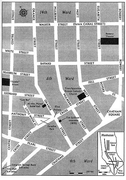
Image: 1851-map-Five Points-NYC
Size of this preview: 422 × 599 pixels. Other resolutions: 169 × 240 pixels | 640 × 909 pixels.
Original image (640 × 909 pixels, file size: 56 KB, MIME type: image/jpeg)
Description: Map of the Five Points neighborhood in NYC
Title: 1851-map-Five Points-NYC
Credit: http://www.historycooperative.org/journals/ahr/107.2/ah0202000351.html
Author: Chris Robinson
Usage Terms: Public domain
License: Public domain
Attribution Required?: No
Image usage
There are no pages that link to this image.

All content from Kiddle encyclopedia articles (including the article images and facts) can be freely used under Attribution-ShareAlike license, unless stated otherwise.