
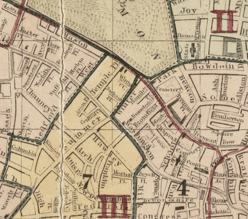
Image: 1861 WinterSt map Boston Dutton BPL11002 detail
Size of this preview: 677 × 600 pixels. Other resolutions: 271 × 240 pixels | 804 × 712 pixels.
Original image (804 × 712 pixels, file size: 1,010 KB, MIME type: image/png)
Description: Detail of map of Boston showing Winter Street, Central Court, and vicinity. From: "A new & complete map of the city of Boston, with part of Charlestown, Cambridge & Roxbury"
Title: 1861 WinterSt map Boston Dutton BPL11002 detail
Credit: http://maps.bpl.org/details_11002
Author: E.P. Dutton & Co.
Usage Terms: Public domain
License: Public domain
Attribution Required?: No
Image usage
The following page links to this image:

All content from Kiddle encyclopedia articles (including the article images and facts) can be freely used under Attribution-ShareAlike license, unless stated otherwise.