
Image: 1869 Map of San Luis Parc of Colorado and Northern New Mexico
No higher resolution available.
1869_Map_of_San_Luis_Parc_of_Colorado_and_Northern_New_Mexico.png (482 × 351 pixels, file size: 344 KB, MIME type: image/png)
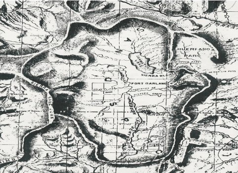
Description: Historic 1869 Map of San Luis Parc of Colorado and Northern New Mexico by Brayer W. Blackmore. "Sawatch Lake" at the east of the San Luis Valley is the closed basin play systems. The Blanca Wetlands are at the south end of the lake.
Title: 1869 Map of San Luis Parc of Colorado and Northern New Mexico
Credit: http://www.blm.gov/pgdata/etc/medialib/blm/co/field_offices/slvplc/blanca_wetlands.Par.10962.File.dat/Historic%20Photos%20of%20the%20Blanca%20Wetlands%20ACEC%20and%20the%20Closed%20Basin%20Playa%20Systems.pdf
Author: Brayer W. Blackmore
Usage Terms: Public domain
License: Public domain
Attribution Required?: No
Image usage
The following page links to this image:

All content from Kiddle encyclopedia articles (including the article images and facts) can be freely used under Attribution-ShareAlike license, unless stated otherwise.