
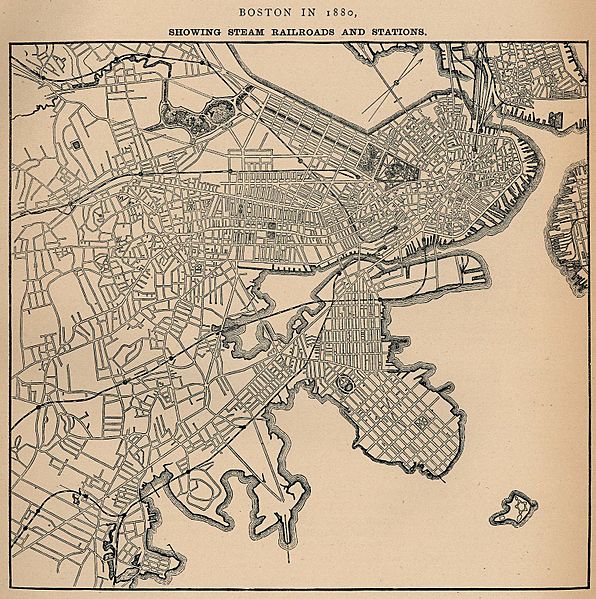
Image: 1880 Boston railroads map

Size of this preview: 596 × 599 pixels. Other resolutions: 239 × 240 pixels | 1,546 × 1,554 pixels.
Original image (1,546 × 1,554 pixels, file size: 654 KB, MIME type: image/jpeg)
Description: Map of Boston in 1880, highlighting railroads and railroad stations.
Title: 1880 Boston railroads map
Credit: University of Texas Library
Author: Unknown author
Usage Terms: Public domain
License: Public domain
Attribution Required?: No
Image usage
The following image is a duplicate of this image (more details):
The following 2 pages link to this image:

All content from Kiddle encyclopedia articles (including the article images and facts) can be freely used under Attribution-ShareAlike license, unless stated otherwise.