
Image: 1893 U. S. Geological Survey Map of Portsmouth Harbor
No higher resolution available.
1893_U._S._Geological_Survey_Map_of_Portsmouth_Harbor.jpg (800 × 600 pixels, file size: 178 KB, MIME type: image/jpeg)
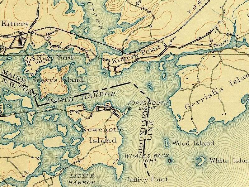
Description: Portsmouth Harbor -- detail of 1893 U. S. Geological Survey map. Courtesy of the Dimond Library, Documents Department & Data Center, University of New Hampshire, Durham, NH. This shows Seavey's Island before it was conjoined with Fernald's Island, site of the Navy Yard.
Title: 1893 U. S. Geological Survey Map of Portsmouth Harbor
Credit: see above
Author: U.S. Geological Survey
Usage Terms: Public domain
License: Public domain
Attribution Required?: No
Image usage
The following page links to this image:

All content from Kiddle encyclopedia articles (including the article images and facts) can be freely used under Attribution-ShareAlike license, unless stated otherwise.