
Image: 1901 Sanborn Fire Insurance Map - Piety Hill - Des Moines, Iowa

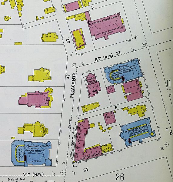
Description: A 1901 Sanborn Fire Insurance Map cropped to show the "Piety Hill" area of Des Moines Iowa, United States. The Central Church of Christ (blue, lower left), St. Paul's Episcopal Church (blue, lower right), the Jewish Synagogue (pink, center), First Baptist Church (blue, center right), and Central Presbyterian (top, pink). St. Paul's, now a cathedral, is the only one of these buildings that remains.
Title: 1901 Sanborn Fire Insurance Map - Piety Hill - Des Moines, Iowa
Credit: File:Sanborn Fire Insurance Map from Des Moines, Polk County, Iowa. LOC sanborn02629 003-29.jpg
Author: Unknown authorUnknown author
Permission: This map is available from the United States Library of Congress's Geography & Map Division under the digital ID g4154dm.g02629190101. This tag does not indicate the copyright status of the attached work. A normal copyright tag is still required. See Commons:Licensing for more information.
Usage Terms: Public domain
License: Public domain
Attribution Required?: No
Image usage
The following page links to this image:
